December 17th
Ketatahi Trailhead (707.4)-Whakapapa Village (723.9)
Mileage: 16.5mi/26.6km*
*Mileage and elevation chart do not include our Mt Doom side trip summit.
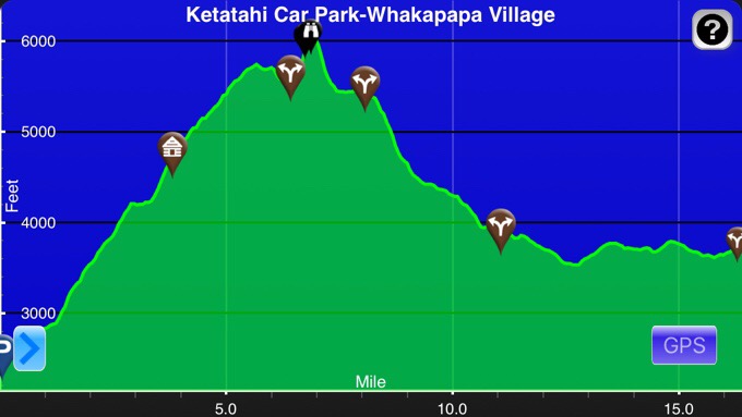
Elevation chart courtesy of Guthook Hikes Te Araroa App.*
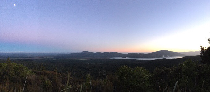
The moon and the sun.
First glimpse of the sun.
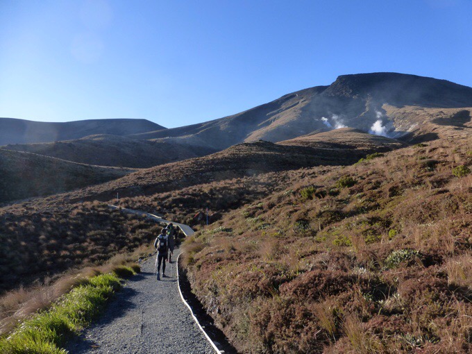
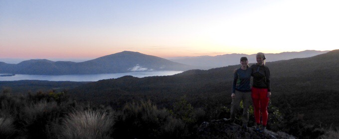
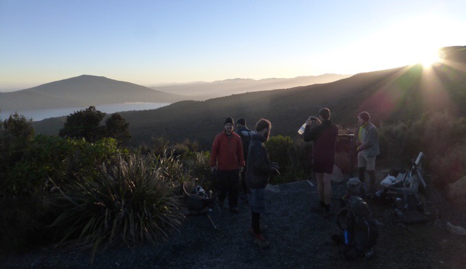
We took our time today stopping to really take it in. We took a break at the Katatahi Shelter, which had water and toilets, but is no longer in use due to rockfall damage from a volcanic eruption a few years ago. Weather was ideal with completely clear skies, hardly any wind at all, and warm weather. It really couldn’t be a better day to do this hike.
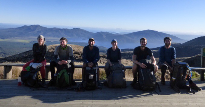
Becky (ULA Circuit), Tom (Osprey Exos), Felix (Pa’lante Packs Simple Pack), Me (Gossamer Gear Mariposa), Frits (Osprey Xenith), Ned (Granite Gear Crown VC 60)
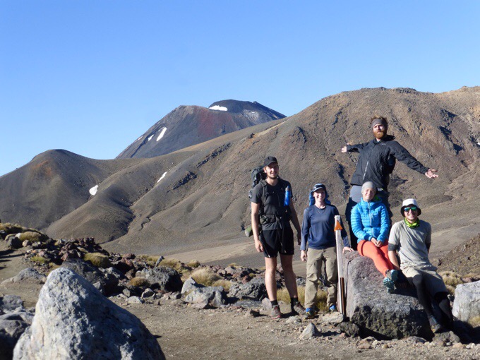
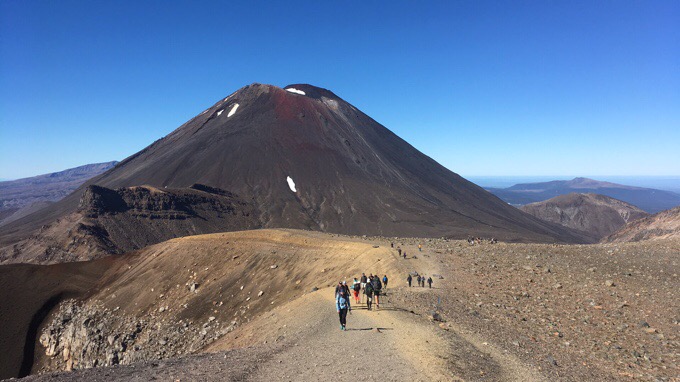
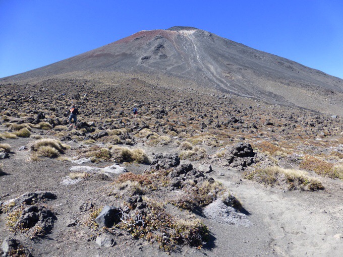
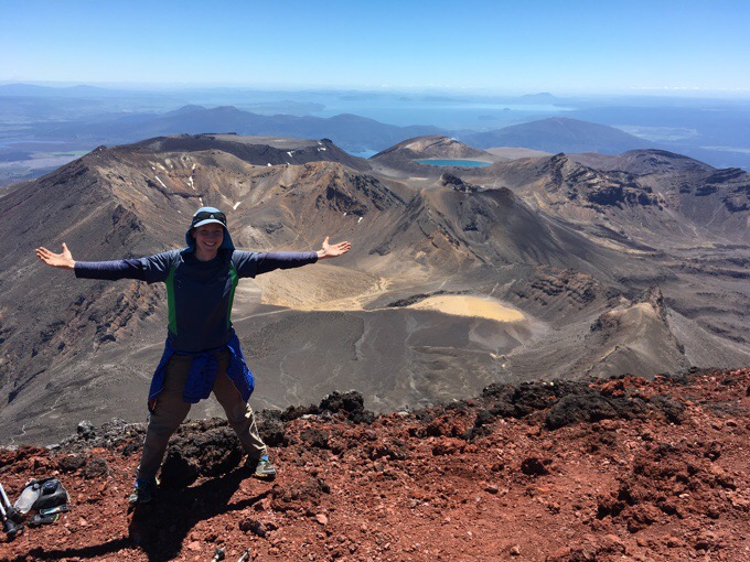
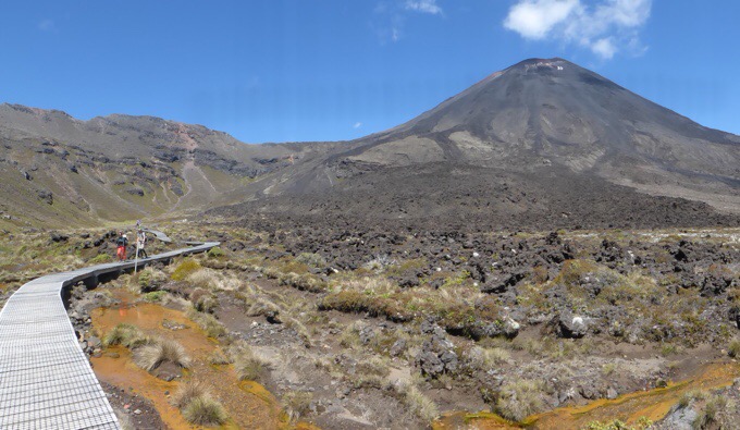
Our first view of Mt Doom/Mt Ngauruhoe in red.
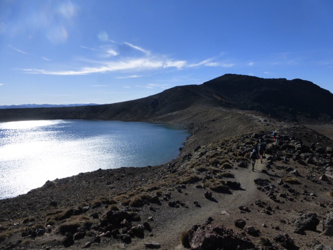
Blue Lake
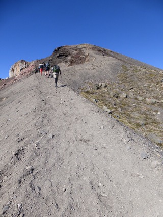
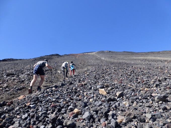
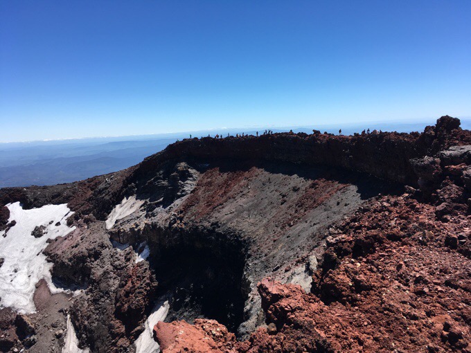
The climb up to Red Crater.

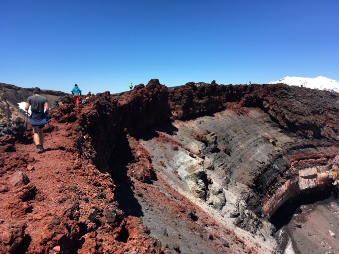
Red Crater and Mt Doom.
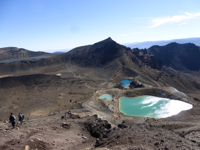
Looking back on Emerald Lakes.
Yep, we’re going up that!
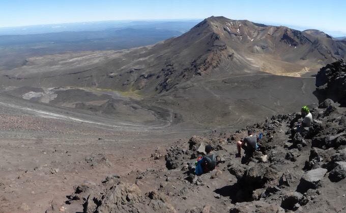
Break #1 looking across to Tongariro Mtn.

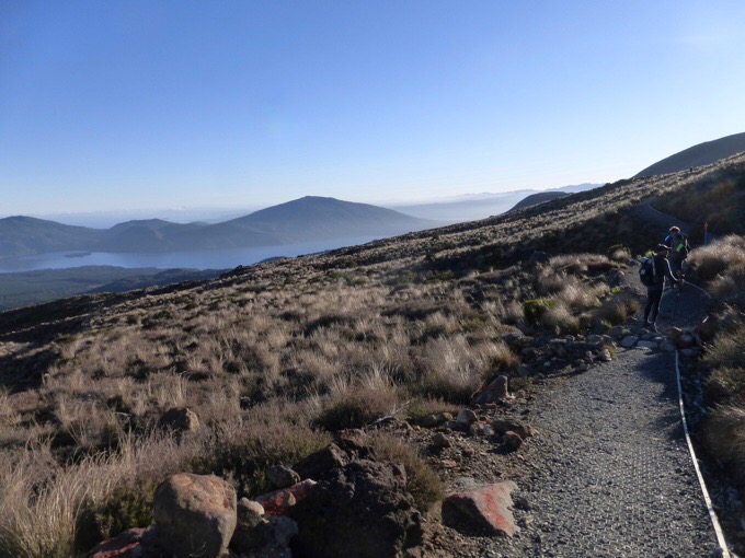
Break #2: See Blue Lake in the distance and Lake Taupo even further?
We spent about an hour on top. You can actually walk around the whole crater, which was pretty cool. It was a perfect day to be up there with hardly any wind and warm temps. So rare for up there and we wished we had brought lunch to have it up top. We just figured it would be cold and windy.


Mt Ruapehu

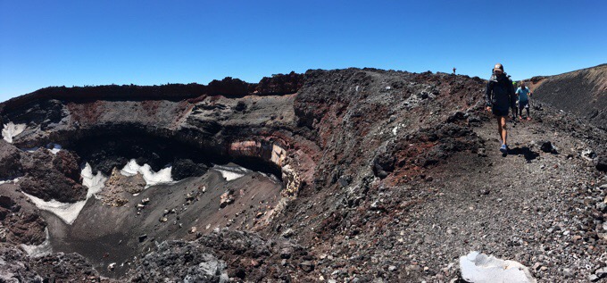
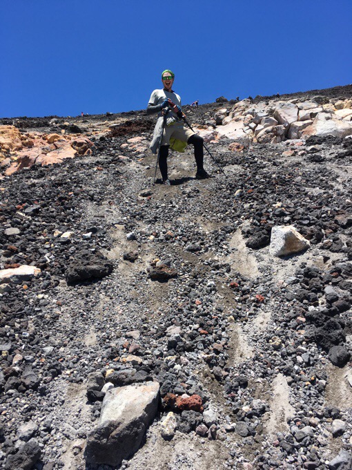
The descent down is controlled chaos. There are chutes of sandier looser scree that people basically leap/ski down. Poles make this much more fun and I flew down. There were some in the group that got some good scrapes with small falls on the volcanic rock.
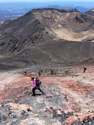
Controlled chaos descent.
The photo so embodies the joy of Tom.
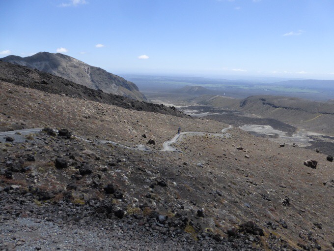
The final 9mi/14km was the killer. It was longer than we all expected and the sun was quite hot. The first 3mi/5km stretch to the Mangatepopo Hut had a nice boardwalk and steps as it is where the majority of people start the Crossing. Since we spent so much time on the Mt Doom side trip, we had the whole descent with no crowds. It was awesome to have such a busy place be calm and quiet.
Looking back.
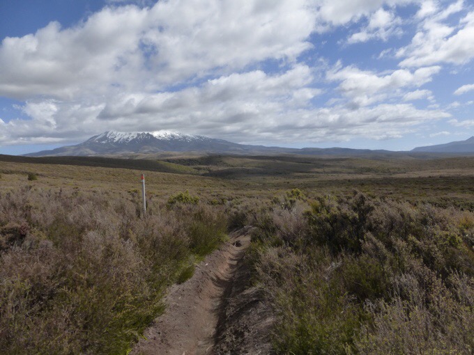
Clouded Ruapehu.
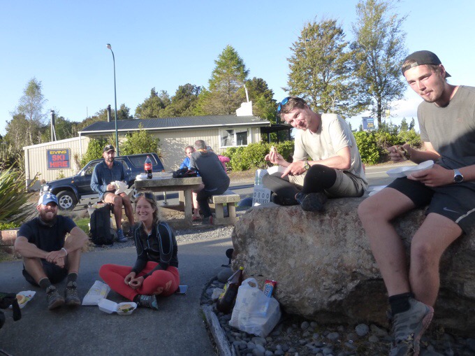
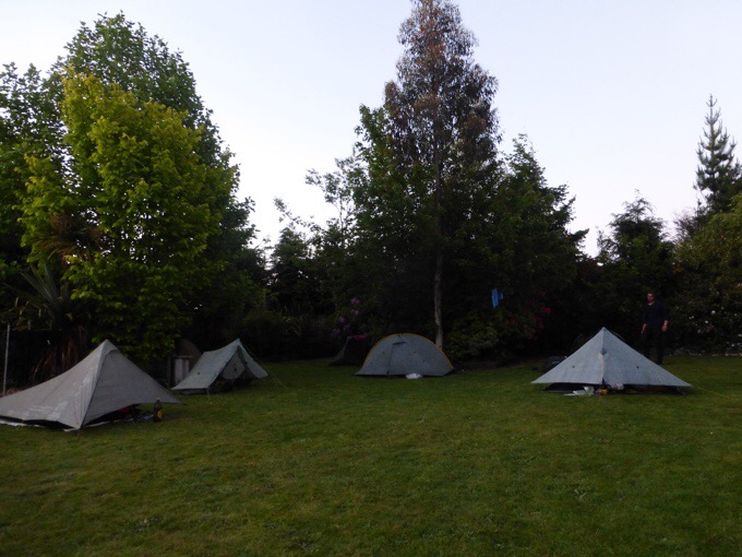
With this day being so perfect, many TA hikers hitched over from wherever they were on trail to do the Tongariro Crossing today. I felt like we were seeing TA hikers everywhere, and it was like a reunion with all the past hikers we’ve met. It was nice to get a day with Felix too. We are tenting ($15NZ/$11US) at the YHA hostel in National Park, and it’s packed on a Saturday night with tourists and TA hikers. Great wifi (for a price), and I’m happy to be able to upload all these photos.
All day today, I went back and forth on wanting to do the 10hr+ hike tomorrow that would complete the Northern Circuit around Mt Tongariro. Felix and Will did it yesterday and really enjoyed it. If we did it tomorrow, it would mean we’d have to do a pretty big day the next day to still make our canoe launch day for the upcoming stretch on the Whanganui River in a couple days (I’ll explain that more tomorrow). This day was quite tiring, so we decided not to push it. I’m spent, and squeezing that in would have required a rushed turn around. We won’t hit town for a week once we leave National Park, and just getting resupplied, blog posts, showered, emails, and charging things will take time. I’d rather do that all leisurely than rushed. Plus, I want to watch the Survivor finale! Sad, but true. This leg did have short days, but the cold wet weather takes a toll. The rest will be welcomed:) All of it was worth it to get such an ideal day for the Tongariro Crossing and Mt Doom!


Such perfect weather, so happy it worked out for you guys 🙂 Photos are amazing! I was on the look out for your post this evening, excited to see how it went. But weirdly while I waited, I turned on the TV and Lord of the Rings was actually on! Couldn’t believe it 🙂 Then I watched an episode of The Big Bang Theory and LOTR was referenced in that too!! How funny 🙂
Looking forward to hearing about the canoe section coming up, intrigued how that works.
Oh it was fated!
What a great day! I´m happy for you that the weather worked out so perfect:-)
Now that’s MY kind of hiking (although I must say all the roots and mud in the forests remind me so much of Hawaii)!!! What an amazing day you had! I’d be happy to lose my umbrella for a cloudless, windless, warm crossing and ascent of Mt. Doom! Go Erin!
Loved that you were rewarded for your flexibility and patience. YEAH! You’re growing 🙂
Favorite photo has to be the one with Red Crater and Mt Doom, but a lot of awesome ones. What a fantastic day, so different from everything else you’ve experienced in NZ.
And you know Felix is UL carrying Handy Andy’s awesome Pa’lante Pack.
Yes, he’s by far the lightest one out here!
What an amazing day for an amazing hike! Beautiful photos Wired! X
Awesome day.
Ngauruhoe is actually the third highest mountain in the North island
Taranaki is 2518m
Ruapehu is 2797 m, but people often get fooled by the steepness of Ngauruhoe, it makes it look taller since Ruapehu is a much broader mountain.
Good to know! I was misinformed. Fixed it.
Did you find the ring??
I may or may not have a great shot of a ring being thrown that didn’t make it to the public…
We missed the crossing twice due to weather. Sorry we missed it, looks spectacular.
Oh man, my sister missed it when she came here for her honeymoon.
You state that Mt. Ngauruhoe at 7503 ft. is the tallest mountain on the North Island. In two of your photos you show Mt. Ruapehu which is also on the North Island and is 9177 ft. It would make sense that Ruapehu is taller since it has snow in the photo.
Yep, I was misinformed and fixed it, thanks!
Wow, loved that you were in so many photos. That is so not the norm but it is great to see you smiling and exuberant!
Congrats to you and all that participated. A lot of planning and hard work went into this day but it appears perfect.
Good for you for not overpushing your body to do that 10+hr day. You are going with the flow, that’s so rad!
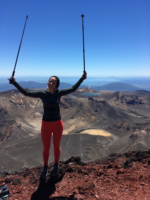
Congrats Becky on the first big climb! You are in big company.
I know, I like photos of what I see more, but I do try to get one in there each day of me if I can:)
Amazing day, group, pictures.. did Becky leave the ring up there?
Also love that you got a glimpse of Lake Taupo.. I have heard about that lake and area and it sounds wonderful.
Hoping the water passage goes well and that you might be reunited with your umbrella ? or a replacement.
There is an awesome ring toss photo I didn’t include assuming someone would be offended…
Hard to imagine anything offensive!
On the Walk with Waard blog, I don’t see any subscribe mechanism…
As a desert rat, myself, it was fun to see the volcanic rock and the red rock and no trees to speak of for a change! (And no rain or mud!) Looks spectacular!