December 18th
National Park(723.9)-War Memorial @ Oio Rd(741.1)
Mileage: 17.2mi/27.7km
Campsite Elevation: 646ft/197m
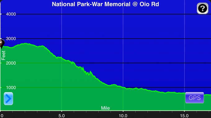
Elevation chart courtesy of Guthook Hikes Te Araroa App.
We all needed a day and a half of food for the days of walking up to the canoe launch. Some bought it from the Four Square in National Park, but it was pretty pricey, so Becky and Frits decided to hitch about 40mins to our last town of Taumarunui where there was a real grocery store. Also, the canoe company was there, and they hoped to add more fun heavy food to their canoe resupplies we will get in a couple days. They planned to drop it off, but coincidentally ran into the canoe guy at the grocery store and he took the food in exchange for them (Frits) helping to load some canoes for him. Nice coincidence! Becky was nice enough to grab me food as well, so I saved some money and didn’t have to spend the day hitching and shopping. She didn’t take her phone because it needed to charge. I joked about my worries letting the “trail babies” go off on their own, especially without her phone. Frits had his, but it is still silly how strong my maternal instinct is with her in particular. Becky knows this and jokingly messaged me through Frits when they were on the way back saying, “Hi we are back soon, only got almost kidnapped and buried in a hole in the bush once.”…I tell ya, the smart ass sarcasm of kids these days…ha;)
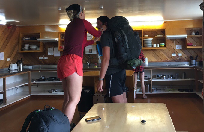
A Frits pack adjustment requires Becky up on a bench to reach with how tall he is.

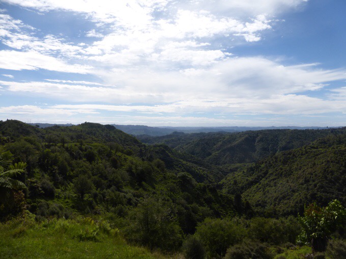
We planned a relaxed walk, but weren’t exactly sure of where there would be camping options as this section is less specific in our notes and on the Guthook app. We saw plenty of water and figured there would be spots somewhere. We hit a good one at 5:45pm, but decided we were in the mood to hike more today. Tomorrow may be a day of rain, so we figured it would be nice to walk more today if we were in the mood.
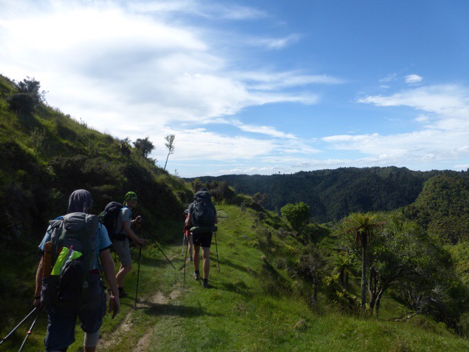
As we walked on, the land became more private with limited options unless we wanted to choose small patches next to fences right along the rarely used road. The guys made a decision at 7pm that they wanted to push on 4mi/7km more to a War Memorial that they had heard had water, a bathroom, and space to camp. I wasn’t clear on if it was an ok spot to camp and didn’t want to be disrespectful to the memorial area, so we chose to hang back and scout other options.


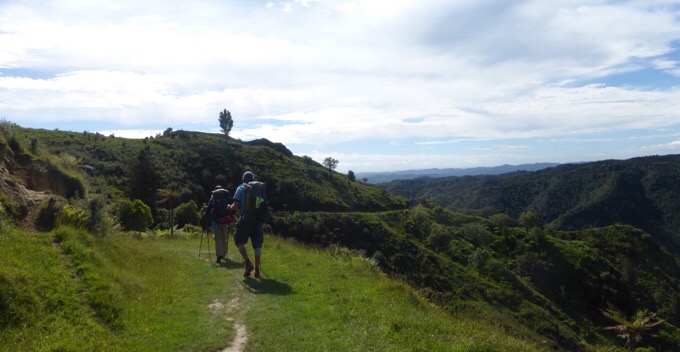
We walked by a home and asked a woman who apologized and said she gets asked all the time, but isn’t interested in letting people camp on her property. Completely understandable and she even said she’s honestly over it. I totally get that and wonder what the future holds as more and more get on the TA and there are limited public spaces to camp. The woman was nice, and mentioned the War Memorial at the end of the road and that there was camping there that everyone uses. She even offered to drive us there. After hearing it was a known camp spot, I was more comfortable with it, and we decided to make a go for it. We decided to make a go for it and play a game of rabbit, which is what we do when we are catching up to someone ahead of us. Becky is quite a fan of this game as well and we had a lot of fun with it.
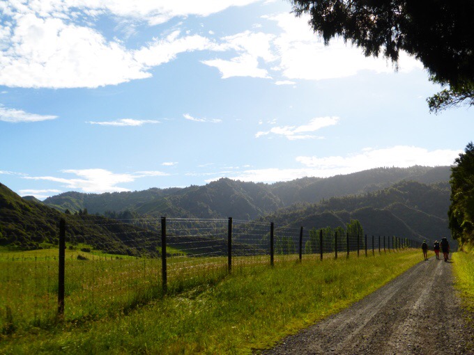
Over a week ago, we had our best one yet when we caught Tom on a long road walk. We saw him way in the distance and spent a better part of an hour catching up to him. He had his headphones on and no idea we were there and scared the crap out him. Oh, the fun, ha! Well, we had fun doing the same thing tonight. We played a game of walking fast and then running on downhills between self-chosen landmarks. Since our packs are empty, we could practically sprint and were entertained. We caught up to Calvin, whose body doesn’t like road walking, and got him to join in for a bit too. My favorite moment was when we were running and Becky with her childish excitement and energy looked back at Calvin (who is not a road walker and best described lovingly as a tech nerd with a very heavy pack) and said, “Isn’t this fun Calvin!?” Without a pause, Calvin dryly responded, “It’s something…” Cracks me up the variety of people thrown together out here!

We did catch up to the guys after a bit longer, and gave them a good jump. That gave them a good push the final 30mins and Tom joined in on the fast walking as Becky played some heavy metal (more like rock for my sake) out loud. Tom is also a fan of rock and heavy metal, so it was a good motivator. We did see two TA hikers camped along the road that are also joining in on the same canoe launch. Becky played some good songs out loud, and I may be gaining some new songs by the end of all this. One had that crazy screaming in it that sounds satanic and I just don’t get it, ha!
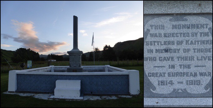
At 8:30pm, we got to the War Memorial to find a water hose near the memorial and a cleared grassy and toilet area across the street. It was perfect and we all set up across the street from the memorial and had dinner as it got darker.
We ended up doing a lot more than we anticipated, and are fine with that as it will give us an easy day tomorrow if it rains a lot. So a short day, but still a long one. We actually did the same distance as we covered doing the Crossing yesterday in just 35% of the time. The ease of miles vary so much out here. Since we are 15.5mi/25km from our canoe launch point at Whakahoro Campsite, and we did 17.2mi/27.7km after 3pm today, we joked that we just need to leave by 3pm tomorrow. It will be nice to sleep in.
**Note: The next 5 days or so will be along the Whanganui River, so I’m not sure how much service I’ll have. No worries if the posts have a gap. You can still see the daily progress on the “Where’s Wired” tab.


Ah all is well again, it’s good to get the daily fix of “Walking with Wired” Erin. 🙂 Always very interesting reading about the track and the interactions of the group.
So you could be canoeing on Christmas Day? Exciting!
We will finish on Xmas Eve.
Enjoy the canoe portion!
Before I forget, I have a suggestion for a homestay coming up–2 days out from Wanganui. I think it’s listed in the trail notes: Mayhem Roost in Bulls – owned by Jo Gallen.
She lives off the trail (well, there was a logging detour our year, so not sure for you). Still, this is a section of urban trail with limited camping options. Not only does Jo offer a great deal (unlimited Internet, laundry), hanging out with her and her family is so enriching. It’s an experience you wouldn’t want to miss!!
If you go, tell her Patrice and Justin say hi and I owe her an e-mail!!
Oh cool! I’ll check it out, thank you:)
Sorry about Survivor.. it was a two hour finale, followed by a one hour reunion show which included announcements about the next season. So I can see the download being chunkier.. slower.
But definitely worth it.
A number of those photos have Becky in front. I guess now she’s a long-trail hiker she’s got ants in her pants! Glad you are having fun and can’t wait to read about the canoe trip.
Merry Christmas!!
She can definitely cruise!