January 9th
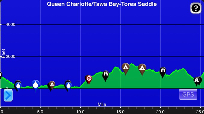
Queen Charlotte/Tawa Bay(1062.1)-Torea Saddle(1087.6)
Mileage: 25.5mi/41km
Campsite Elevation: 1001ft/305m
*Side note: Is anyone aware of an online data sheet for the Abel Tasman? All I have are the distances that the DOC pamphlet has and it only gives distances every 12km or so. I can’t figure out exactly how many kilometers I’ll be going and it would help me to time out the tide if I had something more specific that would give me more detailed distances between each campsite rather than about four of them. Feel free to email me a photo of one if there is a good distance chart in a guidebook or something. I’m sure I’ll also just run into a ton of others on the track and someone is bound to have something more detailed.
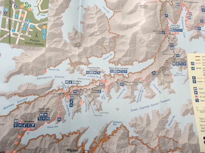
Today was the Queen Charlotte Track cruise. I don’t think there’s been a full day of wide clear track like this all trail. It really is in prime cruising condition. It is a hard clay terrain that is a bit firm compared to a preferred dirt or pine needle track, but it’s still great to stretch my legs on and cruise. To give a better idea of what this track does, I’ve taken a photo of the map on the pamphlet for the Queen Charlotte Track. You can click on it to see it bigger.
Picton is at the bottom. We took the water taxi up Queen Charlotte Sound yesterday to be dropped off at Ship Cove just off the map in the upper right. The track follows the length of the land between the Queen Charlotte Sound and the Kenepuri Sound. I started off this morning on the far end of Endeavour Inlet. My early morning was spent hiking around that inlet. I am in my zombie state from my period and feel pretty zapped without much of a spring in my step. The hike around the inlet felt like it was never going to end.
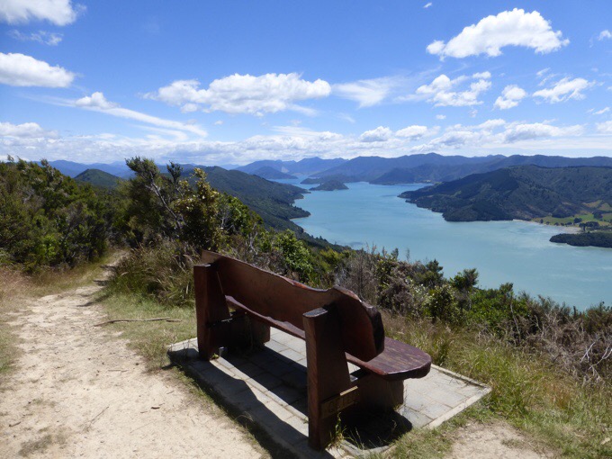
Endeavour Inlet is quite the hub of tourism apparently. There were a lot of private accommodations with side paths leading to them, along with piles of kayaks and various types of boats for tourists to use. There were also random picnic tables and viewing spots with benches all day.
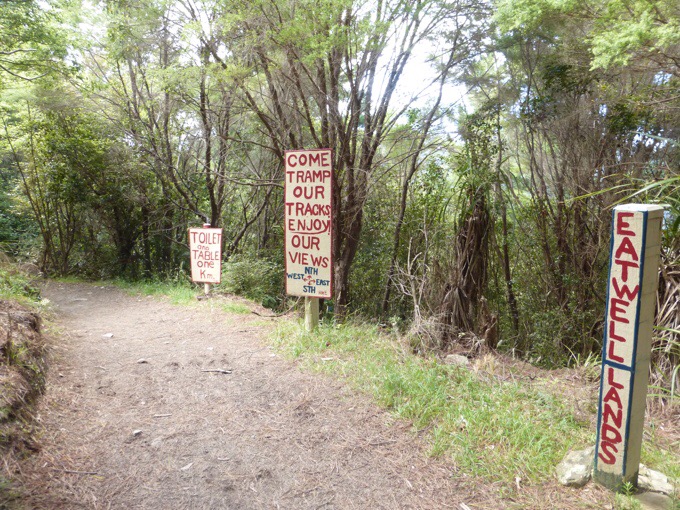
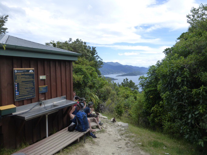
It was an interesting juxtaposition around Endeavour Inlet in particular where there were a lot of signs of accommodations or things for sale hikers might want. It was kinda like billboards along a highway.
There were a fair amount of tourists out for the day, some runners, and some mountain bikers. Few backpackers seemed to be out for the whole track, but I did pass a handful it seemed. The only TA walker I met was a woman that just started yesterday planning to do the South Island. Overall, it was a quiet and calm day.
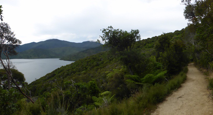
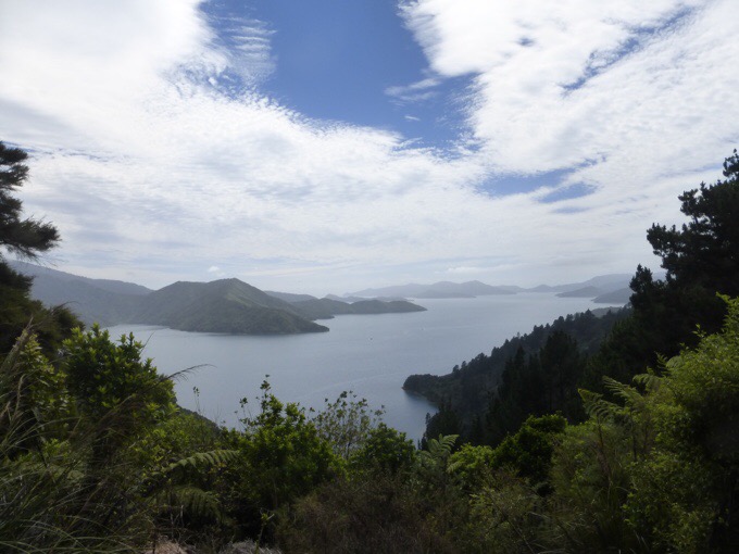
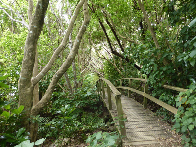
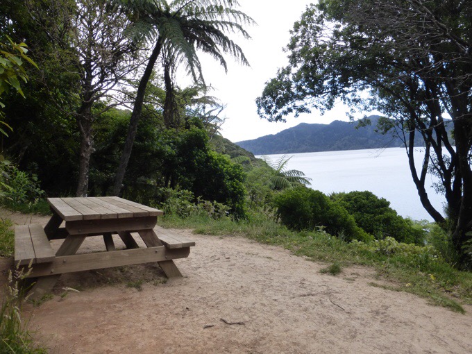
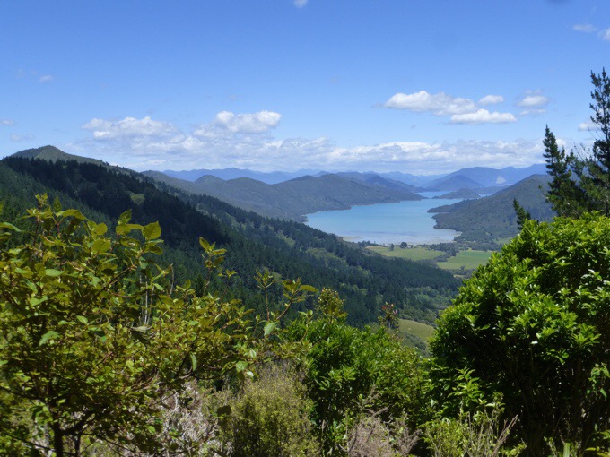
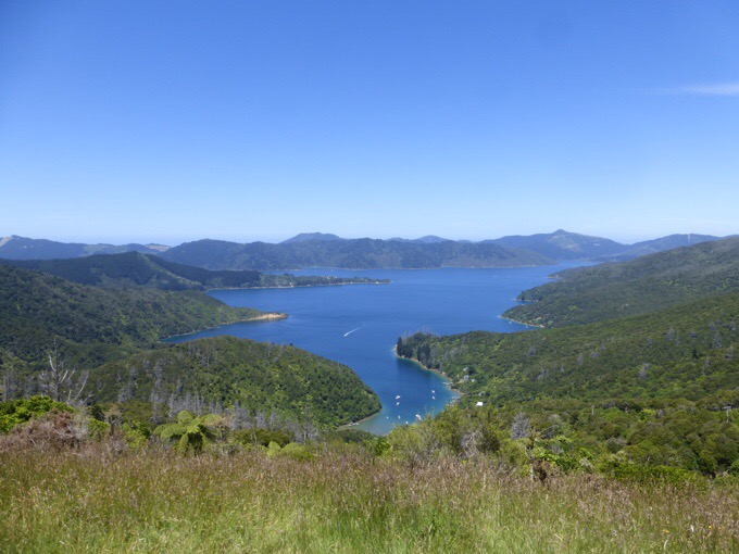
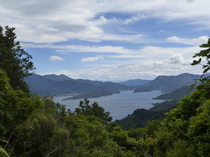
I had lunch on the trail with a view looking down on Kenepuru Sound. I didn’t realize it at the time, but the afternoon was spent hiking down closer along the Kenepuru Sound. The path is a good variety of wooded hiking and views.
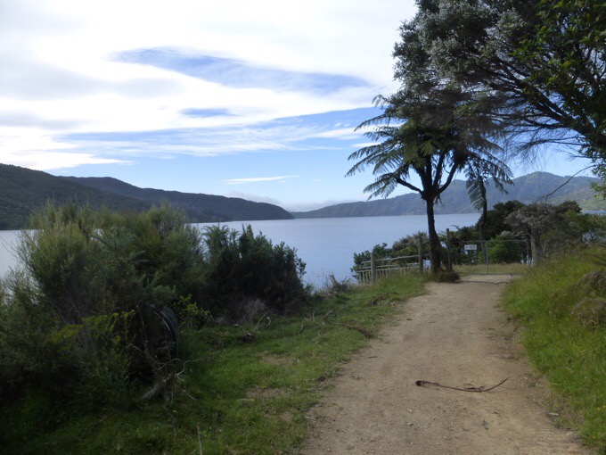
As you can see, there are many inlets, so it can often feel like the same view, but it’s a different Inlet.There was a fair amount of elevation change, but nothing too strenuous. I was groggy all day and just felt like I was out of gas, so the day sorta dragged. I just need to ride it out a day or two more and my energy should be back. It was quite warm today, which is not a condition we’ve had much on the TA thus far. It was in the low 80sF/27C and tomorrow is forecast to be upper 80sF/30C.
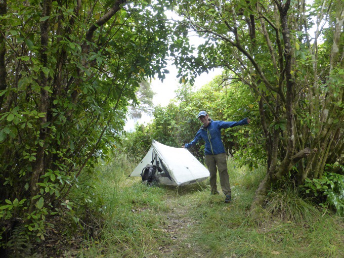
At the end of the day, I passed a Dept of Conservation (DOC) campsite called Black Rock Campsite that was packed. It isn’t far from a parking area, so many families seemed to be there. It had a great view on each side of the ridge of each sound.The final climb up to my camp spot for the day kicked my butt with how I was feeling. I don’t usually sweat a bunch, but my shirt and back pad on my pack was soaked when I stopped today. I lucked out with my camp spot. You never quite know what you’ll get, and I was prepared to have to hike further if it was too exposed because the wind picked up again at the end of the day. It turned out to be perfectly sheltered. It even rained a bit and hopefully released some of the humidity. The wind was gusting pretty strong, and I can still hear it now hitting the trees, but thankfully the tent is fully shielded and hardly even moving.
This is just the third night all trail that I’ve been camped solo. The last night I was solo was on Day 5. It’s been awhile and feels good to have some extended space both physically and mentally to just zone out and be on autopilot. It does feel odd to hike on the TA without Becky though. It feels like the two have become synonymous for me out here. We messaged, and she had a good relaxing half day of hiking, and is camped with Christophe again. I got to watch two episodes of Modern Family tonight. I was pretty wiped out and fell asleep writing with wind and rain lulling me to sleep. I awoke having sweat thru my pjs a bit. My body is just hot and uncomfortable. It isn’t that warm, but my body is just overheated this time of the month, so I have that cold sweat thing going that’s annoying but not unusual. Welp, that’s about it for today. Finishing up the Queen Charlotte Track tomorrow.





I have enjoyed following your adventures since you crossed paths with the Kallins on the AT, what fun. You do such a fabulous job with keeping your blog updated. Thank you!
Here’s a link to a DOC page with three different brochure links.
( I know it’s not exactly what you wanted, but the best that I’ve culled on line.) The first one is a ‘tourist’ map, the second, the walking guide has a profile, the third, a trip info sheet has an overview w/ km’s and times by section.
BTW – I too went looking way back to the beginning of the PCT to see that “it’s been a while.” My congrats to Becky – and to you both!
What a wonderful, inspirational family, the Kallins .. wonder what they are up to this year!
They almost joined me in the Sierra for a bit! Dave’s parents did the AT this past year and they were on trail visiting them this past summer so they are still out there on the trails and want to do more.
Oops, here’s that link!
http://www.doc.govt.nz/abeltasmantrack
Thank you, as I mentioned I do have those, but I was wondering if there something more specific than the wide estimates they give there.
Hi Wired Presume you have the trip sheet from DOC. The times are pretty generous. The track is very easy – its wide and well maintained – even better than QCT. I would expect you to hike much faster than DOC estimates. If you emailed the local office a ranger would be able to give you a better estimates for fast hikers. nelsonvc@doc.govt.nz
I checked our map of the park and it has same times and distances. Enjoy QCT
You have taken some amazing photos, I
Hope you print some. Been so fun to read about your adventures!
This day’s photos are gorgeous! It looks like a paradise! I especially like the shot of the forest with the moss and ferns on the trees and the inlet with the meadows. So pretty!
You’re missing a yucky freezing rain storm in Portland. Makes me excited for summer!
Erin,
The following may help if you are only doing the coastal track. If you are also doing the inland track I will see what I can find.
Day 1, Marahau > Anchorage, 12.4km
Day 2, Anchorage > Bark Bay, 12.1km
Day 3, Bark Bay > Awaroa, 11.4km
Day 4, Awaroa > Whariwharangi, 13km
Day 5, Whariwharangi > Wainui, 5.5km
Regards
Frank
Thank you for that. That’s the breakdown I already have on the DOC stuff…but your distances are different, of course!
Just out of curiosity did you camp in a designated camp site? I suspect you didn’t the previous night when you were still with Becky. I am a bit surprised that freedom camping would be allowed on QCT given how popular it is. I have to admit that I find Becky’s sleeping on a picnic table quite disrespectful.
Karen,
Can’t quite see what you consider disrespectful about sleeping on a picnic table. Have you taken note of what a lot of picnic people do to picnic tables with the crap they often leave smeared all over them. Now that is disgusting, not to mention disrespectful. Some of the picnic tables I have seen I wouldn’t even attempt to eat at with the amount of bird pooh present, not to mention the food residues smeared into the timbers with ants all over the place trying to clean up the mess. I am surprised anyone can find a clean enough place to sleep on.
Frank
“I have to admit that I find Becky’s sleeping on a picnic table quite disrespectful.”
I have now heard it all. I’m surprised I can still be surprised.
Becky did not sleep on a picnic table. She slept on a bench on the Queen Charlotte Track. Which she paid $13 US for the hiking permit to legally hike and camp on. Considering all the campsites she had to pay for on the north island she deserves it!
I may not have been clear- my surprise is that anyone would care about or think it disrespectful to sleep on a picnic table. In my years of bike touring I did this all the time. I don’t understand how it’s disrespectful or what it hurts. In case someone comes along and wants to use it? Because it may make it dirtier?
If someone is hiking 1000s of miles let em sleep on a freakin picnic table without giving them a hard time. Who cares?
Sorry Seth I think I need new bifocals 🙂
I should have commented to Karens post…
I knew someone would comment…like I would purposely post something not legit. There was even a toilet there.
Our understanding is that everywhere we’ve camped has been legit. They do specific no camping at the endpoints, but there are plenty of freedom camping spots available. The ones they don’t want you in are clearly marked. Technically, Becky is on the bench. Also, many hikers sleep on tables regularly. Not sure what’s wrong with it as they participate in Leave No Trace and lay their sleep mat down and I don’t see how it would leave any germs at all.
Erin – for the future reference of anyone who is reading your blog and using it to plan their trip, the QC track pass you bought had ‘camping and toilet use in designated areas only’ written on it. This means you can only legitimately camp in the DOC campsites or in the private ones. The absence of a ‘No camping’ sign in an area does not make it a designated campsite.
Good to know, thank you. I did not see that and would not intentionally break that rule. It seemed on the signage to be open except for the endpoints and the app we use for camping had all those freedom camping spots marked as camp spots. I will let them know as well.
The profile chart from the “abel-tasman-track-guide.pdf” looks as though they made an effort to mark the campsite positions to scale. If you’ve got a print-out of it, you can use a shoelace or compass lanyard to do a rough measure.
Good luck! It’s always fun to follow you – I’ve been doing so since your CDT trek. Great tips and trail beta.
Yep, that’s the one I have. I figured I could guesstimate but I have one long day including the tide and wanted to know for sure. I’m sure my pacing will allow plenty of wiggle room.
Do any of these help with the Abel Tasman Erin?
http://www.doc.govt.nz/Documents/parks-and-recreation/tracks-and-walks/nelson-marlborough/abel-tasman-track-guide.pdf
http://www.doc.govt.nz/Documents/parks-and-recreation/tracks-and-walks/nelson-marlborough/abel-tasman-coast-track-trip-sheet.pdf
http://www.doc.govt.nz/Documents/parks-and-recreation/tracks-and-walks/nelson-marlborough/abel-tasman-coast-track-brochure.pdf
http://www.doc.govt.nz/abeltasmantrack
I already have all those. I’m sure someone will have a more detailed guidebook at my first campsite. I can do the estimates they have, but I like to have more exact distances between each campsite or broken down into smaller segments, but I’ll be fine estimating off what they provide.
May be helpful?
http://www.gps-tour.info/en/tracks/download.92494.html
I tried. It looks like a section hike. Thanks for trying.
Erin, here are the distances and times to various landmarks from my trip in 2013. No doubt you’ll be walking faster, but you can compare to my times and scale appropriately. I had information like this when I walked the JMT and found it very helpful. All distances and times are from Apple Tree Bay.
Apple Tree Bay 0 km 0:00
Jcn to Yellow Pt track 2.1 km 0:23
Jcn to Watering Cove track 5.8 km 1:22
Jcn to Anchorage Hut 6.5 km 1:31
Return from sidetrip to hut 7.3km 1:44
Torrent Bay village 8.7km 2:04
Falls River 12.7 km 3:07
Bark Bay Hut 15.4 km 3:46
Onetahuti Bay (start) 20.4 km 4:56
Tonga Saddle 23.5 km 5:38
Jcn to Awaroa Lodge 24.5km 5:52
Return from sidetrip to lodge 25.5 km 6:08
Awaroa Inlet (start) 27.8 km 6:34
Waiharakeke Bay 30.4 km 7:11
Totaranui Beach (end) 35.1 km 8:12
Anapai Bay 38.6 km 9:05
Anatakapau Bay (end) 40.9 km 9:42
Whariwharangi Hut 44.7km 10:32
Jcn Gibbs Hill track 47.7 km 11:11
Takapau Bay / End 50.5 km 11:43
Oh wow, that’s nice, thank you.
That’s the closest I have to more specific distances, great!
I have heard of people sleeping on tables or benches on trails in many places.. especially valued if there are ants on the ground!
Erin, I remember even with Rockin’ and Why Not you’d get off once in awhile and one time you .. I forget the details but you went ahead to arrange for something and that’s where you met up with those backpacking goats.. which still makes me smile. I saved those pictures.
it will be nice to have a few days on your own, back in your comfortable routine..
Well, except for the heat!
But back home.. brrrr.. even in SoCal we have gotten the edges of the rain and cold and just up in Antelope Valley they have had some snow.
Yosemite had tons of snow and all roads in and out were closed and further north people had to be rescued.
Mudslides in OC in the hiking areas, Mud in SCarolina.
Friends wintering on South Padre Island TX say it is swinging from super cold to hot.
Crazy weather.
I know you do sunscreen, which is good since that area of the world has a higher skin cancer rate due to the hold in the ozone layer.
LOVE your photos from this post! Really beautiful views.
You have such a good memory! You’re right that I do enjoy these breaks to go solo for a bit and I get a good reset. It’s an interesting balance. I have heard about that weather, just crazy!
Beautiful photos. Looks like you had wonderful weather.
The North Island is looking good. Nice track and some solo days ahead.
I do remember back to Jet Cat and you two spending a good bit of time together on the CDT. Does that not compare, in length, to the time you have spent with Becky so far?
I knew I’d get it wrong, even with a 50/50 chance. Should have said the South Island.
Haha!
South Island you mean. JC was three weeks at the end of the AT, but yes, felt much longer. Funny thing cause I just skyped with JC while I was in Wellington. If you’re interested, here’s info on a long distance biking challenge documentary she is featured in coming out this month. http://ertzui.de/LENGTH-OF-SWEDEN
Also, here’s the trailer. https://vimeo.com/186251850/9f0bc2465b
Yes, she’s a badass on a bike as well.
I thought the billboards were pretty gaudy. When I saw that pic it reminded me of US highways before I had read your comment. Ha!
I know, right!?