April 3rd
Lake Oberon-Haven Lake
Mileage: 8km/5mi
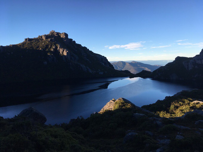
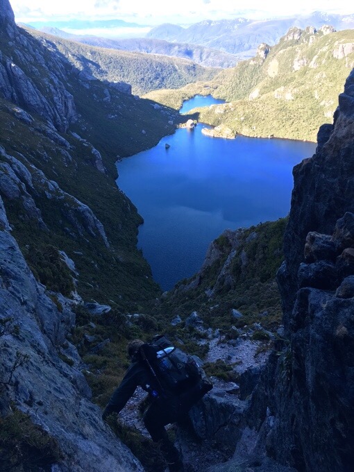
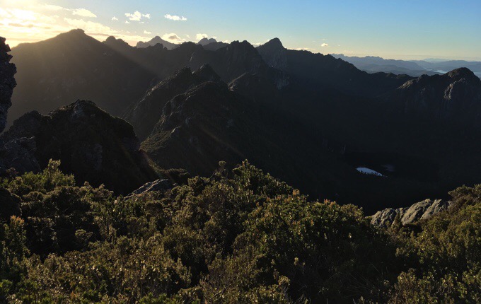
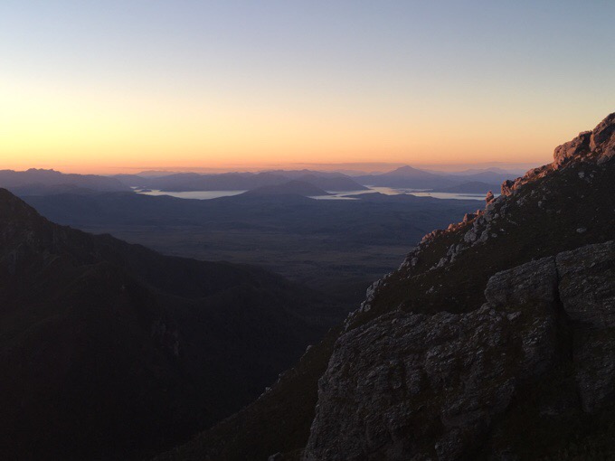
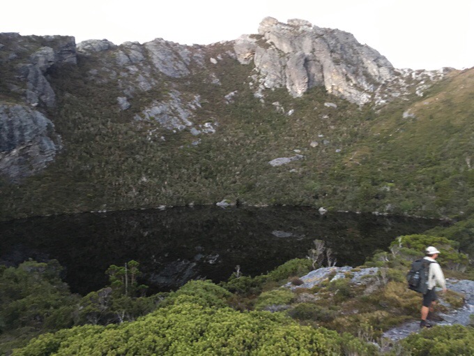
No, that’s not a typo on the mileage today. With a full day of effort, we managed just 8km/5mi over 9.5hrs of hiking time. Just half a mile an hour, and that’s actually fairly fast for this terrain. We left camp this morning to completely clear skies and near freezing temps. It was quite cold, but fortunately not windy. We got the view of Lake Oberon that we didn’t get last night when we came into camp.
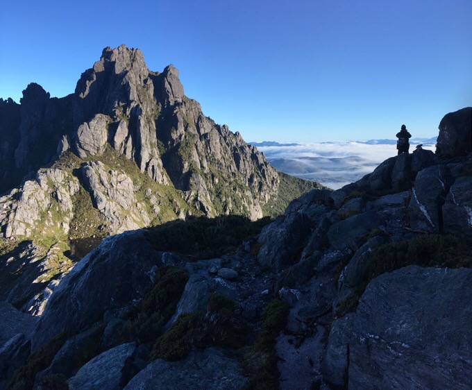
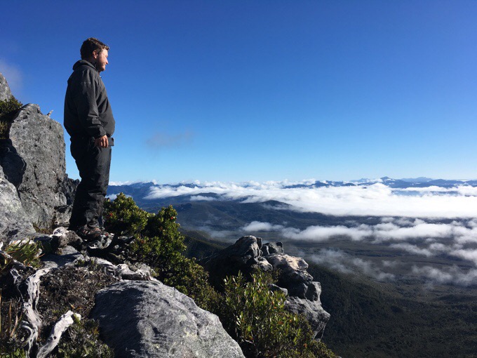
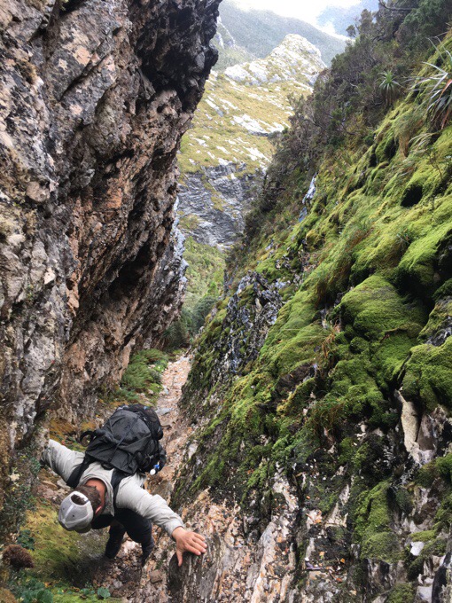
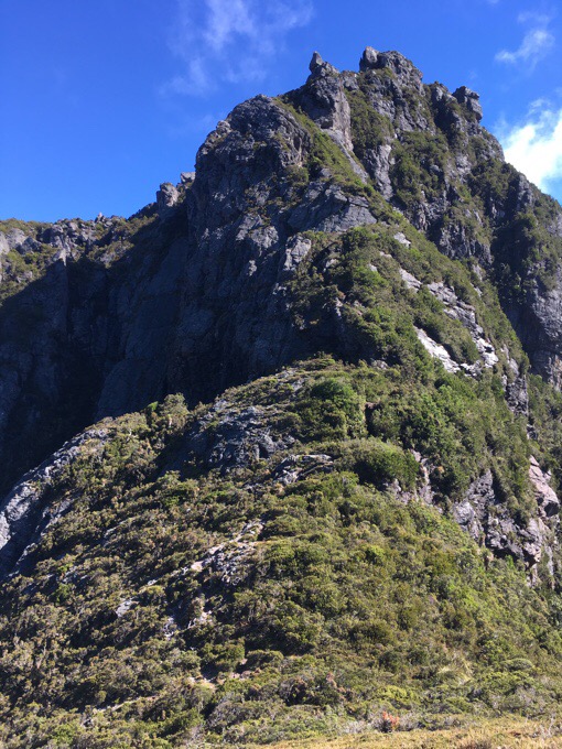
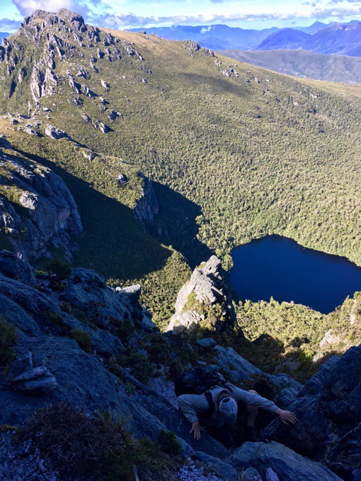
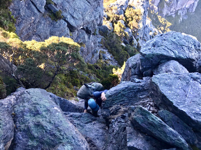
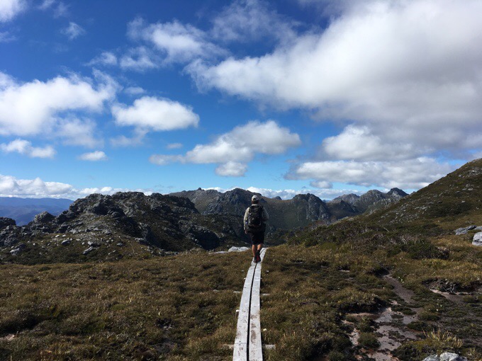
I won’t go into the step by step of today, because it was just a lot of scrambling, moving very cautiously, and making little lateral distance. The Arthurs Range is not one you make miles on. It’s very technical, and the most technical day either of us have ever done. The majority of the day was spent scrambling up or down cold, wet, and slimy rocks and roots. There isn’t a ton of elevation gain and loss that’s time consuming, it’s just very slow going to climb up and down very exposed areas. We knew to expect this, and that this would be very challenging, but also very rewarding. The views were great all day, and we both enjoyed it quite a bit.
The biggest challenge for me is down climbing with exposure. I’m not the biggest fan of heights, and am not confident in rock scrambling, especially with a full pack on. Many times today, we needed to climb down backwards facing the rock. I got more accustomed to it at the end of the day, but there were many times that it freaked me out. I feel like I’m blindly climbing down things and can’t see where my feet are going unless I look down. Doing that freaks me out sometimes, especially on the wet and cold rock when it my hands would get numb on the longer down climbs and I was worried about how slick the slimy rock was. Griggs was amazingly patient in going first and then taking me through where to place my feet and finding handholds if I had trouble. There were a few times I handed my pack down to him to make it easier. He was a great support and I was sure to thank him with Oreos at the end of the day:)
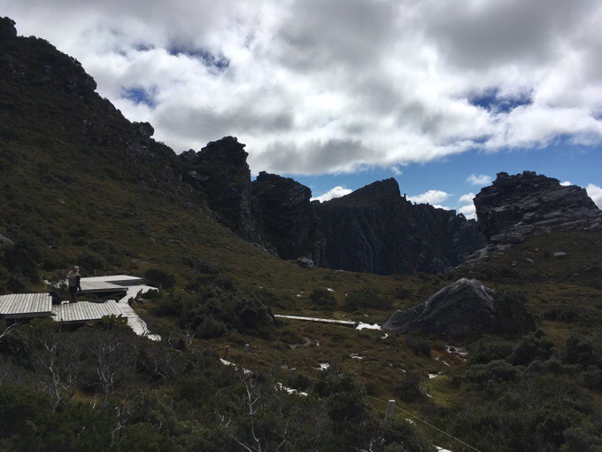
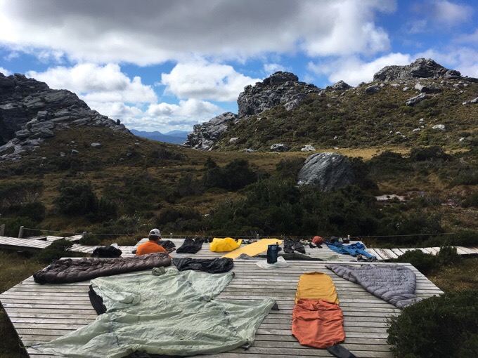
I do want to point out that this route is so difficult that doing 8km/5mi today is two days of hiking in the guidebook. Most people take about 9 days to do this route, and we are fortunate to be able to do it in half that time. Our lunch stop today was the full day planned for the men camped at our campsite last night. I completely get that because we went almost sun up to sun down (days are getting shorter) to be able to make it to the second campsite. The way the campsites are spread, we either do a really relaxed day or a long day. Most choose the more relaxed day (which is still really taxing) and bring more food. I can’t even imagine how people with 9 days of food are doing some of this climbing with large packs on. We made it to lunch at High Moor camp, and had a big ol’ yard sale laying out just about every piece of gear to dry it out after two nights with rain, and no sun yesterday to dry anything out.
After lunch was the more time consuming scrambling, and the most difficult of the whole traverse. In fact, today was the bulk of the difficulty for the traverse. I’m so glad I’m doing this now, while I still can. I can say we are both sore today from using our muscles so differently. As I lay here in my tent, the main source of pain are my knees. My kneecaps are screaming at me like I hit them on something. The whole day was in slow, half bent positions, and the last two hours of the day, my knees were really objecting to the movement of climbing and not fully extending. I hardly ever take ibuprofen and am considering it if my knees don’t chill out.
We ended the day arriving at Haven Lake around 6:15pm, just enough time to get setup as it was getting dark. It’s another cold one tonight, and may drop to freezing again. It feels like it already has. I’m quite cozy in my fleece and sleeping bag. The only thing that bothers me on really cold nights is my nose gets cold. I try to put my buff over my face, but that makes breathing more strained. Sometimes, I cave and stick my head in the sleeping bag. Tomorrow looks to be another great weather day, and it should warm up a bit. Now you can understand why we waited so long for a clear weather window to do this traverse. It really is essential to have dry weather to be able to do this scrambling safely. Such a awesome range!
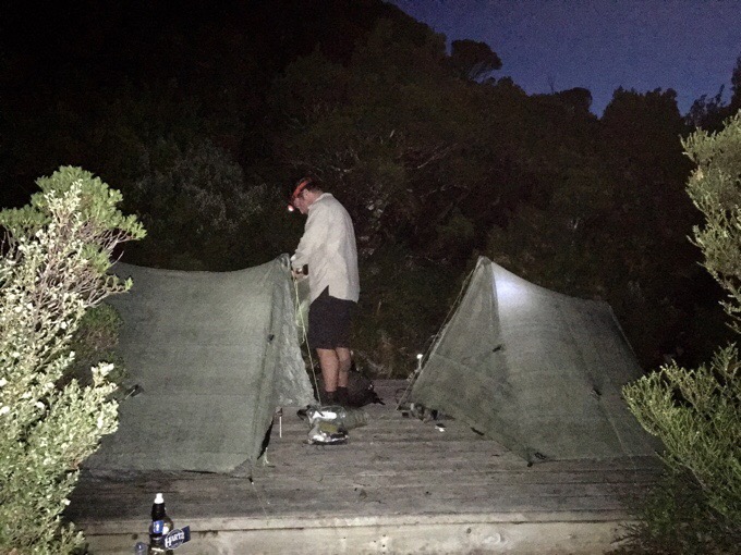
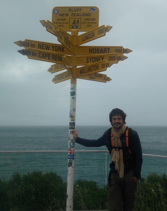
One more thing. Many of you followed my Te Araroa hike and are familiar with Christophe. He had his pack and most his gear stolen 2/3 of the way thru his hike. Many of you offered to donate to help get Christophe back on trail with new replacement gear. He got back on trail a few weeks ago and finished yesterday. Here’s his finish photo, and he wanted to thank you all for your care and generosity. Look at that proud smirk;) Congratulations Christophe!!!

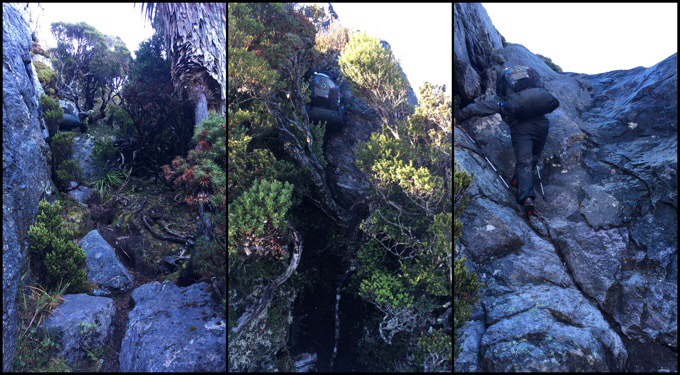
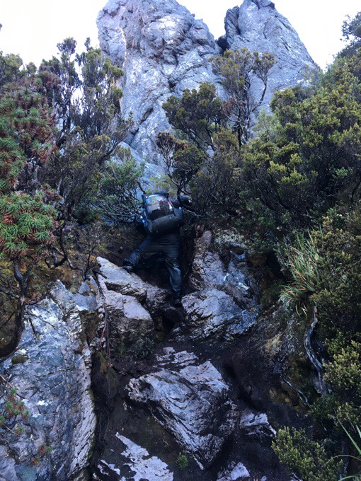
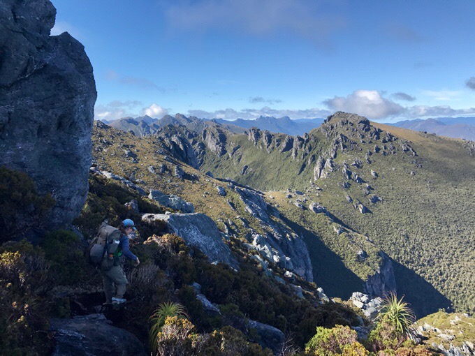
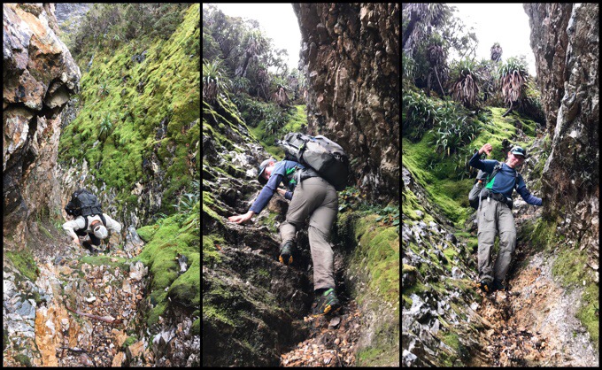
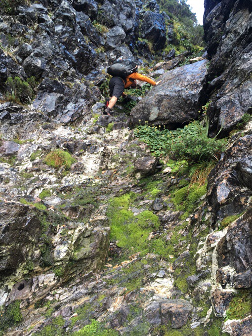
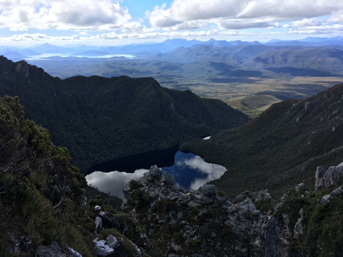

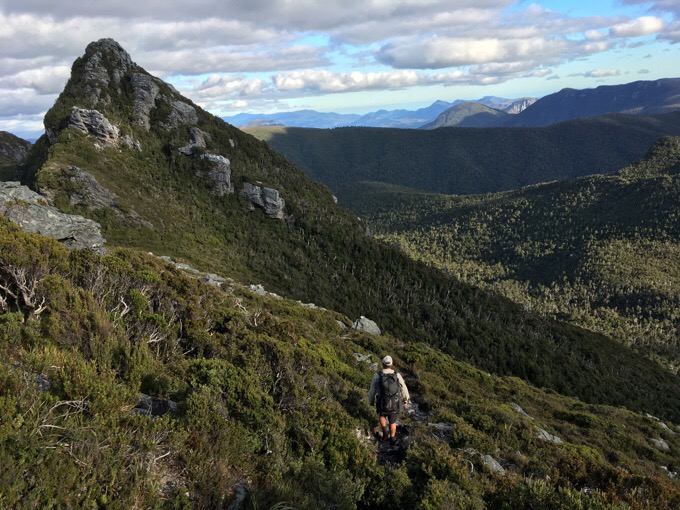
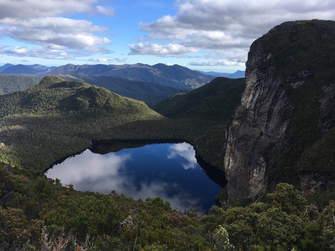


Wow…….great effort Erin and the best photos yet.
That looks like soooo much fun!
Just spectacular!!
Glad you weren’t doing this on your own! I guess some of the places you went with Why Not and Rockin were a good prequel to this.
It really is beautiful and quite the accomplishment.
I hope you did take the Ibuprofen.. those pains are what it is for.
Yes, it had a full circle feel to it. Also reminded me that I’m much more a trail hiker than a rock scrambler.
And.. Sweet to see Chrisophe completing the TA!!
And I thought the JMT was tough! What is the elevation? The best photos by far, thanks….
The elevation was quite tame. Just really time consuming. We could spend 15mins easily figuring out one short down climb.
When I saw the first down climb I’d want my mommy!! Not for me. You say this is the most difficult you and Griggs have ever done. Does that include just Aus/Tas/New Zealand, or does that include all the cross country stuff you did with Rockin’ WhyNot too? Because I remember lots of scary Class 3 stuff you did last year. That wasn’t for me either!
Not the most difficult, but the most technical by far. This was rock climbing basically and not much lateral movement at all. Very slow going just one step at a time practically climbing all day. The high routes aren’t really like that and have lots of physical elevation up and down. The high routes were much more tiring and required more exertion. This was just very slow going and time consuming.
This is amazing! What a beautiful land! Is the trail well marked? Even during the rocky scrambly bits is it well defined or do you need to navigate yourself? This might be one for me after I’ve done many many more other hikes first I think! Amazing but a bit full on for a newbie methinks!
We could see usually where people walked. No official markings, but very convenient cairns guiding the way and piles of rocks blocking where NOT to go. When we went wrong, it was evident pretty immediately with cliff drop offs. Once we went back, we’d find the more obvious route and usually spot a cairn we missed.
Thanks x
Wow! Impressive hiking! I’m glad you are seeing the contrasts between the hikes in beautiful Tasmania.
Great pictures Erin.
I have heard a lot about lovers leap going back to the 1960s, however I have yet to see proper pictures of lovers leap. It sounds like one of the most challenging parts for some. I hope you can document the challenge.
Stay safe and enjoy yourself.
Apparently the trail bypasses that now, so we didn’t see it.
Wow! Spectacular. Impressive. And SCARY!
An amazing country and extremely rugged route. There does not appear to any resemblance of a marked trailed. How did you navigate? Maps, GPS, etc?
I mentioned in other replies there wasn’t a formal path, but one was defined by other waking through and many cairns guiding the way. We enjoyed the adventure aspect of it.
Toughest yet for you is saying something given your completion of the Sierra High Route last year. The fact that your mileage 1/2 to 1/3 of what you did on the SHR is further evidence of the difficulty. Down climbing, especially with a pack is always more difficult tham going up. I had that feeling once last year and then again this past weekend, I’m not going to like going back down this, and I was very right both times. Beautiful photos. Iknow you’ve got to be enjoying it. I always feel like the harder I have to work for a view the better it is.
It was the most adventurous thing either of us have done in quite awhile.
Perfect weather for doing this spectacular hike. Well chosen weather window. Great pics too.
We are so glad it worked out!
WOW, that looks INTENSE! But absolutely gorgeous!!