Sept 6th
Refuge Les Grands-Outside Sembrancher
Daily Mileage: 23.5km
Approx Total Mileage: 12.4mi/20km
Campsite Elevation: 2589ft/789m
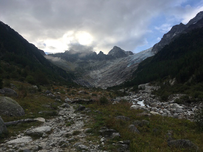
I slept well last night and got going at 7:50am this morning. I was aiming to make it to the village of Champex before noon. I hadn’t looked up when stores closed there, but many things in small villages close for the afternoon. It drives me nuts, but I’ve managed to make it to villages within the open hours most of the summer. The morning started off with a descent down a valley to Chalet Du Glacier, and then a climb up and over Fenêtre d’Arpette.
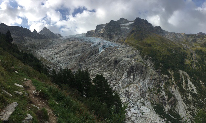
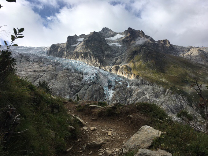
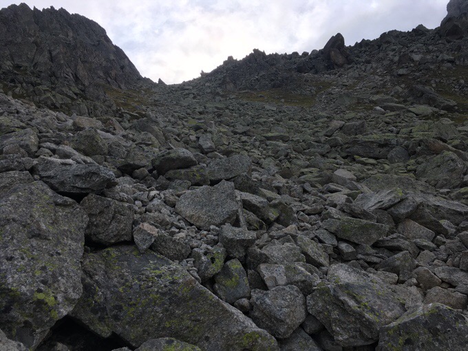
With each one of these trails, I need a couple days to adjust to how each guidebook is written. I’m terrible with reading and this guidebook (the Cicerone Press one) is overwhelmingly wordy for me. I’m one of those people who skips detailed instructions when it feels overwhelming and skims for main points. That was a bad idea today. I saw the distance, and failed to notice the suggested timing or elevation. Due to the elevation and terrain, the climb up and over Fenêtre d’Arpette was over an hour longer than expected. Had I read closer, I would have known that it was a 3550ft/1082m climb over just 2.8mi/4.5km. I hadn’t done a climb that steep for that long in awhile and my body felt it. The view was awesome though!
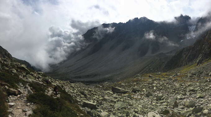
I think the glacier on the upper right is part of the Trient Glacier. The book is so wordy that I can’t tell if they even say the name of it. They do point out how it’s sadly shrinking. The climb took about 2hrs and there was a great view of the glacier the whole time. I took a ton of pictures as it looked so much cooler as I got closer. I’ve already found that my phone’s camera doesn’t have the wide angle lens to capture the grandness of so many of the views out here. I’m going to try posting some that are taken in panoramic mode (like the photo above) to capture more, but I’m not sure how well they upload to the blog posts. Are they ok in size/appearance? The quality is a bit lower, but captures a wider view. Photos can be clicked on individually to see them larger as well.
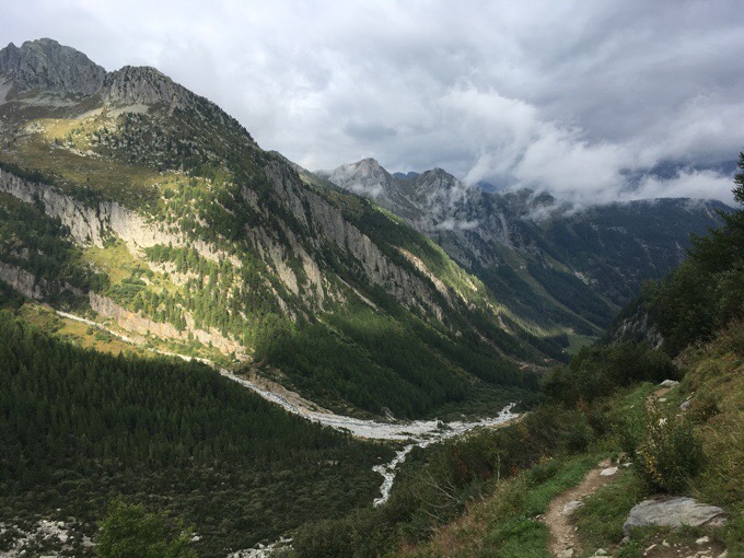
The view looking back down valley was also pretty great. Some fog rolled in and out, but thankfully never fully caught up to block the view I had looking ahead. At one point, I glanced back a few minutes after taking a photo of the valley and saw nothing but a wall of fog right behind me. It came so quickly and was a total whiteout behind me for half an hour before moving on. I feel like in Switzerland, and especially during the shoulder season, anything can happen at anytime regardless of what the weather forecast is, and that’s an intimidating thing.
The final stretch to the top of Fenêtre d’Arpette (8743ft/2665m) was rocky, but had a defined way.
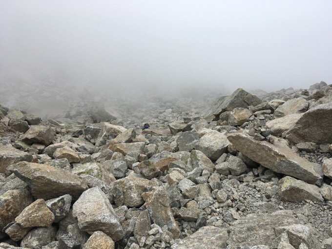
Once up top, I was met on the other side with another wall of fog. It was crazy that I’d look one way and have a clear view of a valley, and then the other was a total whiteout. It was a really rocky descent for the first 40mins or so.
I also hit the wave of Tour Du Mont Blanc (TMB) hikers heading the opposite direction as me. It was a good 50 people. They must have all left the same refuge about the same time. The TMB has the most Americans on it I’ve seen all summer. The TMB was not on my list of hikes to do as it seems overly hyped, commercialized, and packed with people to the point that I’d be stressed. I knew there were a lot of people doing it, but this is late in the season, and I still saw tons of hikers today until the paths diverged after Champex.
Once off the rocks and lower in the Arpette valley, the fog cleared enough to see the view, yay!
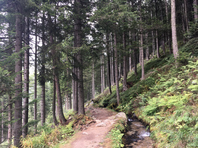
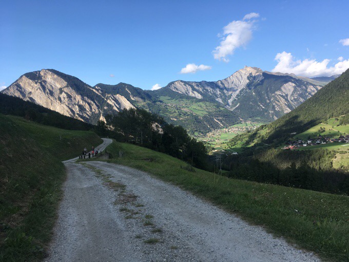
The path varied as trail, track, and road as it went down valley to Champex. It followed a cute little manmade waterway that intentionally diverts the water to where it’s needed.
I got to the post office and store at 12:50pm, and it had closed at 12:30pm. It wasn’t going to open until 3pm, and surprisingly, this didn’t bother me at all. I went to the tourism center and used the somewhat average wifi to load the blog and catch up on correspondence while I ate my lunch. The time flew, and before I knew it, the store was open. I hardly needed anything, but I did have a Swiss SIM card sent to me from a very kind blog follower that lives out here and offered to add me to his phone plan. I was contemplating not getting a SIM and only using wifi for the time I’ll be here, so this was exciting. Long story short, for some reason, the card won’t work. We might figure it out, but for now, I’ll be sticking to wifi and posting when I can from towns.
A side note about Champex. It seems I’ll have some extra days possibly between finishing the Haute Route and my flight out of Geneva. The current plan is to return to Champex and hike the half of the TMB I didn’t already cover along this route and the GR5. It gets me back to my things I left in Chamonix and gives me something to do during that time. So, although the TMB wasn’t high on my list, I may finish it off this trip after all.
I somehow spent 3hrs in Champex and walked out at 4pm. I know foul weather is on the way in 2.5 days, so I have a goal of where I’d like to be by then, and decided to hike a bit later today since I’d missed some hiking time being in town for awhile.
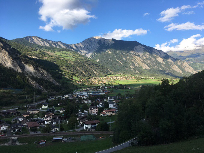
The remainder of the day was relaxed walking mostly on track or road down a nice valley to the village of Sembrancher. It was good to end relaxed today. I’m still adjusting and need to find my rhythm out here. Today was a bit askew in a few ways for me with timing and comfort.
Not long after Sembrancher is apparently the main village of this area, Le Châble. I found myself between the two, and didn’t want to get too close to Le Châble and be unable camp, so I kept an eye out as I went through a forested stretch outside of Sembrancher.
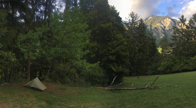
I was able to find a good hidden protected spot just a bit off the route when I climbed up an old path a bit. There’s a major road about a kilometer away, and the surprising traffic will be my white noise for the night. Temps are just right down here in the valley, and I’m happy to be low tonight. There’s a bit of a breeze in the exposed areas and the forecast has that temps are going to be dropping as this cold and wet front moves through. It should be colder tomorrow, especially up high, but dry for two more days. Fall is coming…


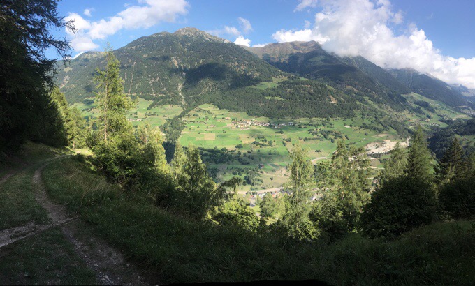

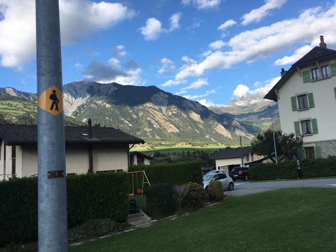


The sign reads that they are growing herbs for the famous Ricola Swiss’ Herbs Candy= Ricola Schweizer Kräuterzucker (I translated it almost literally maybe it’s not exact)
Oh cool! I hadn’t loaded the Swiss google translate into my app:)
Beautiful Scenery. I’m inspired, by your whole trip, to know there is so much hiking/nature left even in the most developed areas of the world. Are there many people on the trail. You look like your all alone out there (not always a bad thing).
Oh I love having it to myself. I tend to see people in groups at more accessible sections but get through them quick and then have people speckled through the day. Less now that I’m not overlapping the TMB and not on the schedule of hikers in shelters. If you use shelters and the book itinerary, you could be in a herd of 30 or more a day.
The pictures look great, no worries! Thanks for blogging!
Simply stunning!
I hiked the Haute Route a few years ago, and it was amazing (although I did it too quickly). The climbs are indeed pretty steep. https://heavyhiking.blogspot.com/2012/07/haute-route-journal-part-4.html
Maybe some of the stuff in here is useful for your hike (or not).
Thanks!
Pictures are good, even on my small tablet.
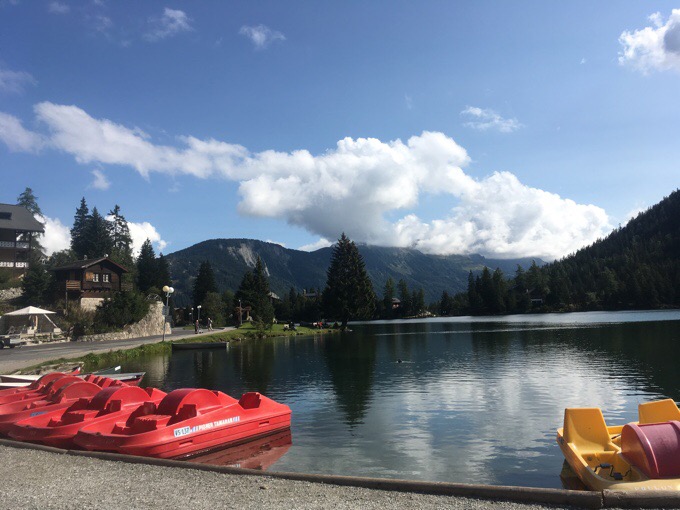
On the TMB we spent a night in Champex. The pic of the lake brought back some wonderful memories. You are a great blogger, Erin. Thanks for taking the time to share your journey.
I worried the TMB didn’t go that way and some didn’t see it at all along the TMB.
Great to see the pictures which bring back memories of walking this route about ten years ago. It’s worrying to see just how much the Trient Glacier has retreated in that time. The man-made watercourses are called ‘bisse’ if I remember correctly. Tomorrow you should follow one across open hillside, giving easy, level walking as it contours around the mountain.
I learned that term bisse the next day when someone told me I could get water at one and I said what’s a bisse? Of course it was in my wordy guidebook;)
The photos you said are panoramic just look like the rest, at least to me they do.
“You are a great blogger, Erin. Thanks for taking the time to share your journey.” Totally agreed Margo.
Your images are fine and you certainly have a good eye for taking pictures. They are consistently awesome!
On my blog I post many pictures but try and keep the image size around 100kb or under.
I am aware some folk might be on small data plans, and I don’t want to eat up their precious megabytes with huge 1mb plus images.
Yes, to do that too. I have an app, Photogene⁴ that I run them through to resize them and make them smaller both for viewers and my loading speed:)
I am an avid reader of your blog, but I don’t post comments nearly as much as I’d like, mainly because my life is insanely busy with three kids. I was so sad to read your post the day before this one, about the fires in Oregon. My heart hurts so much you because it’s obvious how much that area means to you.
I was actually supposed to board a plane this morning from Atlanta to through like the Wonderland Trail (and your posts about the trail have been so helpful!) starting tomorrow, but the smoke and fires in Washington had other plans for me, so I am now headed back to my home in North Carolina.
Since I have a week off of work and my husband geared up with meals and such for himself and the kids, I’m desperately looking for somewhere to use my airline points that I wasn’t able to use to go to Washington. Interestingly, flights to and from Geneva are booking low with , frequent flier miles, so I’m tempted to come walk the same route that you are walking right now… but I’m a little concerned about the weather reports on finding online. If you see this, would you mind giving me a little bit of insight on temps, conditions, etc. since this post? I don’t want to fly all the way over there and do you have weather related challenge of a different sort!
I’m always inspired by your adventures and can’t thank you enough for sharing them! 🙂
Not a good time to come! Temps are taking a nose dive starting today. Like well below zero and precipitation on and off, brr. It skipped fall and went straight to winter. Taking today off to see my options…i have 2wks to kill…
I can’t thank you enough for answering my question! I woke up this morning, still within the window of time to book the flight at get to the airport, but it sounds like it wouldn’t be the best time to head there, sadly. I hope you figure something else out and I look forward to following the journey, wherever you end up. Thanks again–I really do appreciate the help! 🙂
Whew! Close one. Definitely the right choice!