
Sponsors


Day 58: Threading The Needle
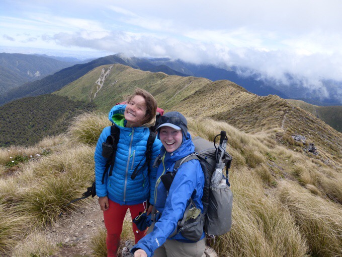
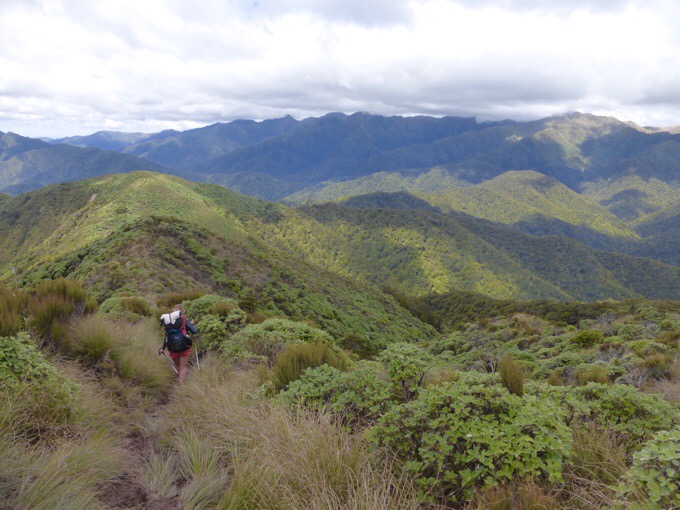
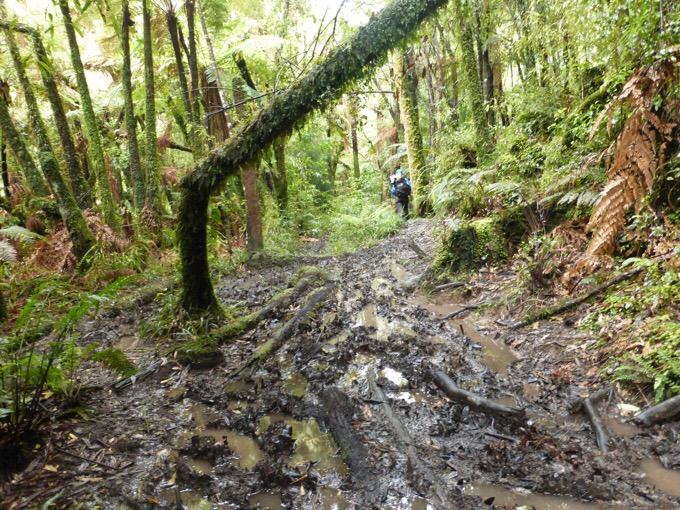
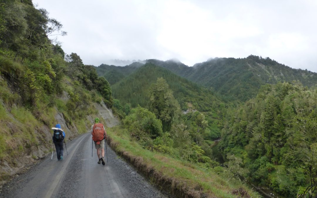
December 31st Te Matawai Hut(967.2)-Waitewaewae Hut(979.7) Mileage: 12.5mi/20.1km Campsite Elevation: 1020ft/311m Today was the big day with the push to get over Mt Crawford before inclement weather moved into the Tararua Range. Our goal leave time was 5:30am and we...
Day 57: A Clear Beginning To The Tararua Range
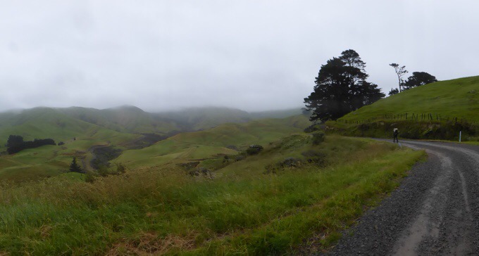
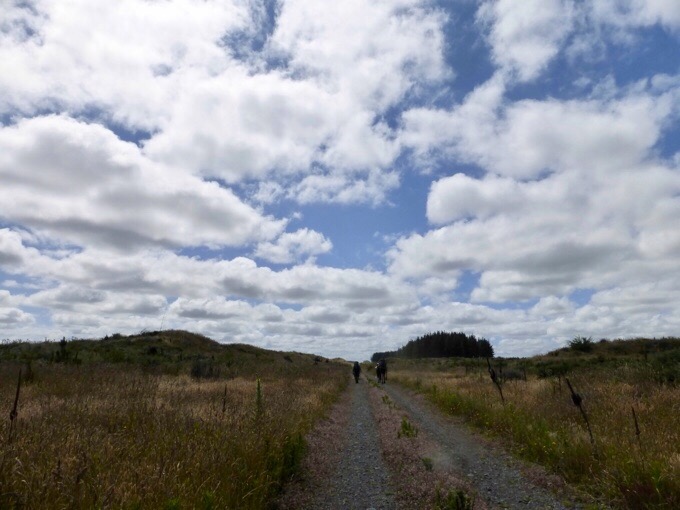
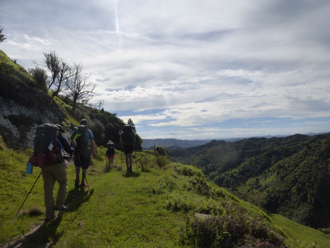
December 30th Gladstone Rd/Levin(954.5)-Te Matawai Hut(967.2) Mileage: 12.7mi/20.4km Campsite Elevation: 2899ft/884m It was a great night of sleep at Sarn and Claire's. Sarn gave us a ride back to the trail, and we got started at 7:40am. We had just over an hour of...
Day 56: The Cold and Wet Squishy Squashy Slog
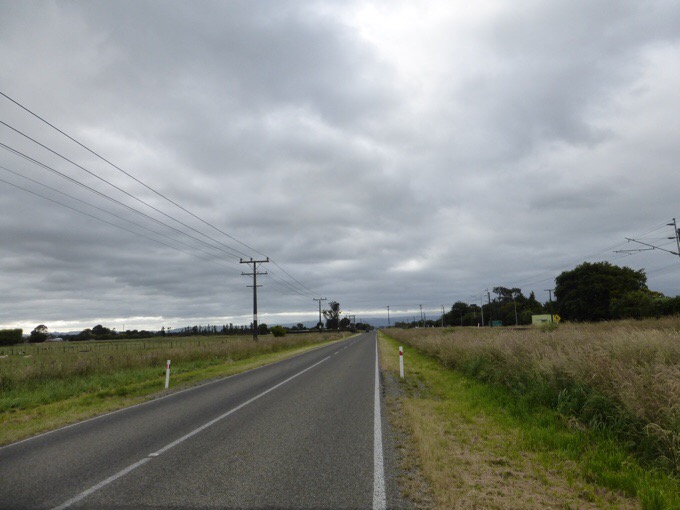
December 29th Burtons Track/Tokomaru River(939.6)-Gladstone Rd/Levin(954.5) Mileage: 14.9mi/24km Oh man, I slept hard last night. It had to be the combo of yesterday's hiking, the cold wet air overnight, some rain on the tent, and the white noise of the river. I was...
Day 55: Filling The Tank
December 28th Palmerston North(917.5)-Burtons Track/Tokomaru River(939.6) Mileage: 22.1mi/35.6km Campsite Elevation: 638ft/194m Note: If anyone would like to see the hilarious video I mentioned on Day 46 about my missing umbrella and what my hiker friends did with it...
Day 54: A Solo Day To Recharge
December 27th Mount Lee Reserve Campground(896.2)-Palmerston North(917.5) Mileage: 21.3mi/34.3km Campsite Elevation: 108ft/33m I woke up at 5am with the birds like usual. I still had the strong urge to get some solo time, so I decided to pack up and head out. I wanted...
Day 53: A Sunny Day For A Group Walk
December 26th Koitiata Campground(873.4)-Mount Lee Reserve Campground(896.2) Mileage: 22.3mi/35.9km Campsite Elevation: 393ft/120m I was awake pretty early and energized to hike, but we had agreed on a 7:30am leave time, which became 7:45am. My solo self is pushing...
Day 52: Christmas On The Road
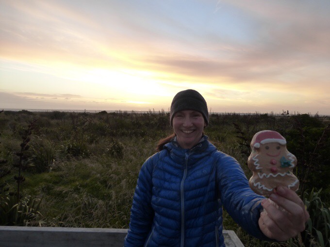
December 25th Whanganui Holiday Park(851.1)-Koitiata Campground(873.4) Mileage: 22.3mi/35.9/km Campsite Elevation: 15ft/4.7m Since it was Christmas morning, and everyone stayed up pretty late last night, we got a relaxed start aiming to leave at noon. No one was...
Day 51: Christmas Eve With The Trail Family
December 24th Hipango Park(838.6)-Whanganui Holiday Park(851.1) Mileage: 12.5mi/20.1km* *Mileage done on a canoe. We had just a couple hours to town, and big plans for Christmas, so the group impressively chose a 7am launch time on the canoes, and most of us...
Day 50: The Canoe Novelty Wears Off
December 23rd Next to Moutere Island(813.2)-Hipango Park(838.6) Mileage: 25.4mi/40.9km* Campsite Elevation: 95ft/29m *Mileage done on a canoe Our group planned leave time was for 8am this morning, but a handful stayed up quite late last night talking and...
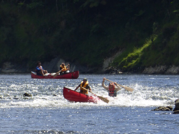
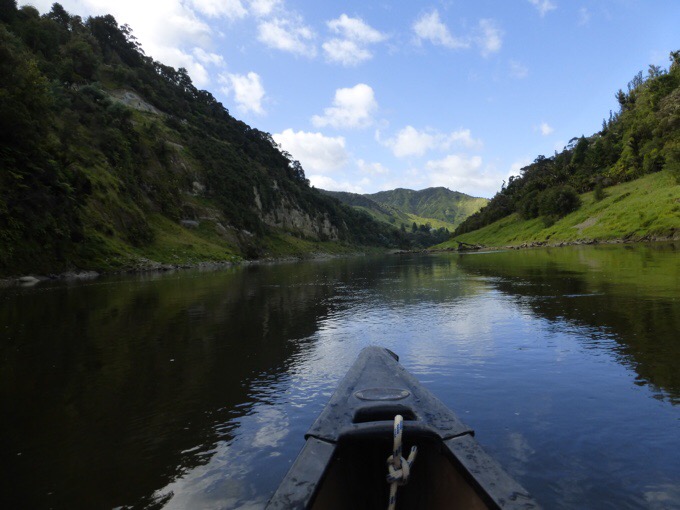
Day 49: Earning Our River Rapid Merit Badges
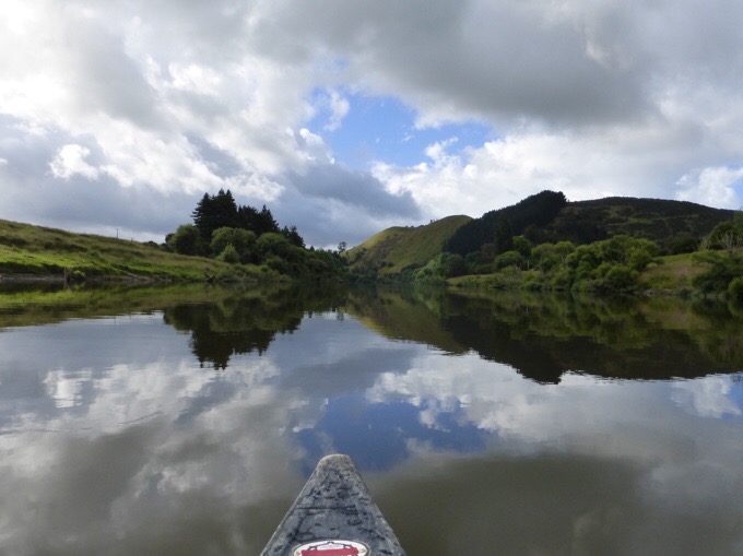
December 22nd Tieke Marae Campsite(786)-Next to Moutere Island(813.2) Mileage: 27.2mi/43.8km* Campsite Elevation: 39ft/12m *Mileage done on a canoe All sixteen of us set off around 8am for a full day of paddling ahead. The morning started off pretty slow with a...
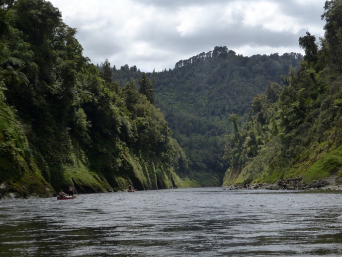
Day 48: Just Around The River Bend
December 21st John Coull Campsite(783.1)-Tieke Marae Campsite(801.1) Mileage: 18mi/29km* Campsite Elevation: 270ft/82m *Mileage done on a canoe Since today was a short day of paddling, the group had a relaxed morning and set off around 9am. I had crashed pretty early...
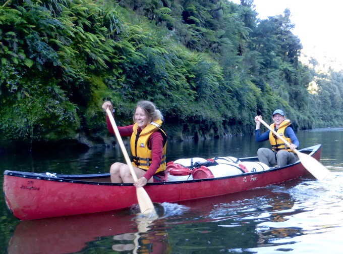
Day 47: Getting Our Feet Wet
December 20th Whakahoro Campsite(756.7)-John Coull Campsite(783.1) Mileage: 26.4mi/42.5km* Campsite Elevation: 326ft/99m *Mileage done on a canoe It was a relaxed morning because the canoe company wasn't arriving until 9:30am. It was nice to sleep in and get the...
Day 46: A Reunion, In More Ways Than One
December 19th War Memorial @ Oio Rd(741.1)-Whakahoro Campsite(756.7) Mileage: 15.6mi/25.1km Campsite Elevation: 364ft/111m The forecasted rain came in overnight and it rained lightly through the night. I slept awesomely with the sound of the light rain and cool...
Day 45: Fisher’s Fast Track
December 18th National Park(723.9)-War Memorial @ Oio Rd(741.1) Mileage: 17.2mi/27.7km Campsite Elevation: 646ft/197m We all got sucked into the hostel vortex and didn't leave town until 3pm. Don't even ask me how, but I still managed to watch no shows, dang! I hadn't...
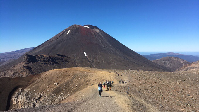
Day 44: Finally, Tongariro Crossing & Mt Doom!
December 17th Ketatahi Trailhead (707.4)-Whakapapa Village (723.9) Mileage: 16.5mi/26.6km* *Mileage and elevation chart do not include our Mt Doom side trip summit. Since this was a special day, this will be a picture heavy post. So many photos! We got our early...