
Day 20: Goodbye North Carolina
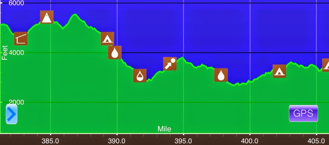
May 6thStan Murray Shelter(381.2)-Tentsite S of USFS 293(405.9) N Carolina/Tennessee24.7miElevation chart courtesy of Guthook's AT Hiker app. He has apps for many trails including the PCT and CDT. I started hiking at 7am and I always like early morning hiking light...
Day 19: A Day With Lead Legs
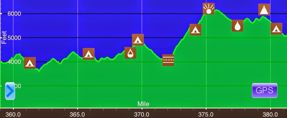
May 5thCherry Gap Shelter(359)-Stan Murray Shelter(381.2) N Carolina/Tennessee22.2miElevation chart courtesy of Guthook's AT Hiker app. He has apps for many trails including the PCT and CDT. Last night was wonderful! Nice and cool but warm enough that I didn't use the...
Day 18: An Enjoyable Uphill Day
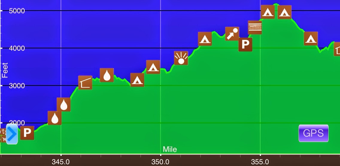
May 4th River Rd/Erwin,TN(341.7)-Cherry Gap Shelter(359) N Carolina/Tennessee 17.3mi Elevation chart courtesy of Guthook's AT Hiker app. He has apps for many trails including the PCT and CDT. I was up til almost 1am last night at the hotel doing blog and email stuff....
Day 17: Downhill Day To Erwin
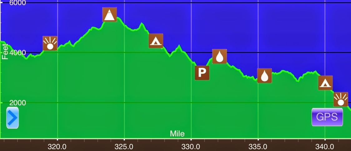
May 3rd Just before High Rock Viewpoint(315.8)N-River Rd/Erwin,TN(341.7) N Carolina/Tennessee 25.9mi Elevation chart courtesy of Guthook's AT Hiker app. He has apps for many trials including the PCT and CDT. I was up and hiking by my regular 7am start time. The...
Day 16: Jello Wired
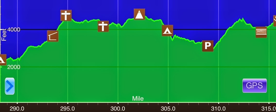
May 2nd Allen Gap(288.4)-Just before High Rock Viewpoint(315.8)N Carolina/Tennessee 27.4mi Elevation chart courtesy of Guthook's AT Hiker app. He has apps for many trails including the PCT and CDT. I got going by 7am this morning. Anyone who has read my blog on...
Day 15: I Could Get Used To This
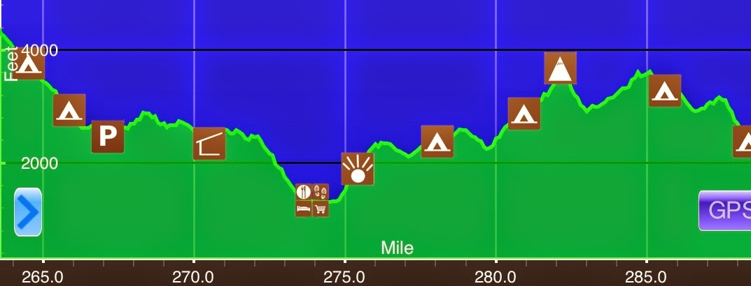
May 1stSpring S of Bluff Mtn (263.8)-Allen Gap(288.4)N Carolina/Tennessee24.6miElevation chart courtesy of Guthook's AT Hiker app. He has apps for many trials including the PCT and CDT. Last night it rained pretty hard for about an hour around 10pm. The wind gusts...
Day 14: A Bit Of Everything
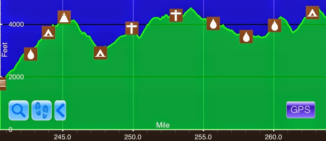
April 30th Standing Bear Hostel(240.5)-Spring S of Bluff Mtn (263.8) N Carolina/Tennessee 23.3mi Elevation chart courtesy of Guthook's AT Hiker app. He has apps for many trials including the PCT and CDT. After a nice breakfast with Diana and Joey, I returned to trail...
Amicalola Falls-Standing Bear Farm(-8.8-240.5)
At the end of a section every few weeks, I like to load all the pictures and videos I've taken as a summary of that section. Here is the slideshow of the first 240mi. I wasn't able to load video (I only had one of Amicalola Falls), but I'll try to load it at a later...
Day 13: My First Zero In Newport
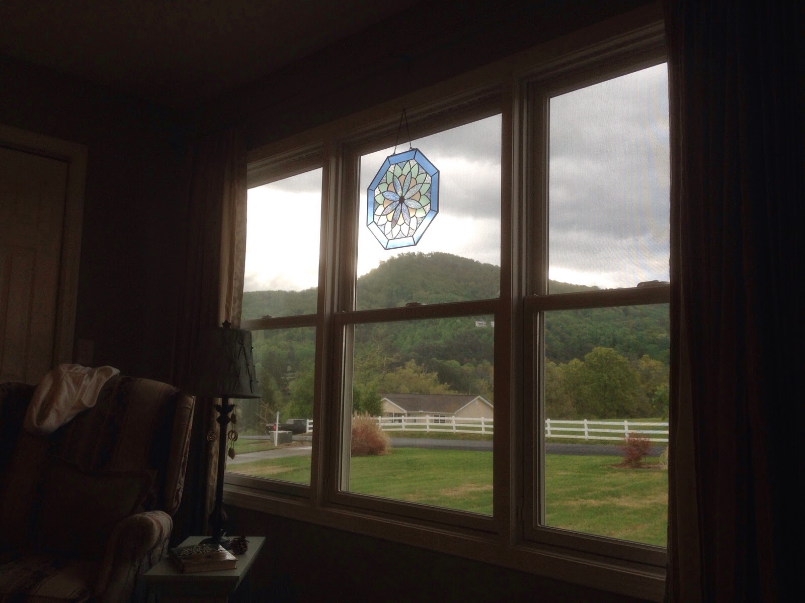
As I explained yesterday, I am took my first zero at Diana and Joey's today. It was a very relaxing day and just what I needed. The weather did not materialize to the extremes that were predicted and it was actually sunny most of the day. This is the view I had of the...
Day 12: Calm Before The Storm
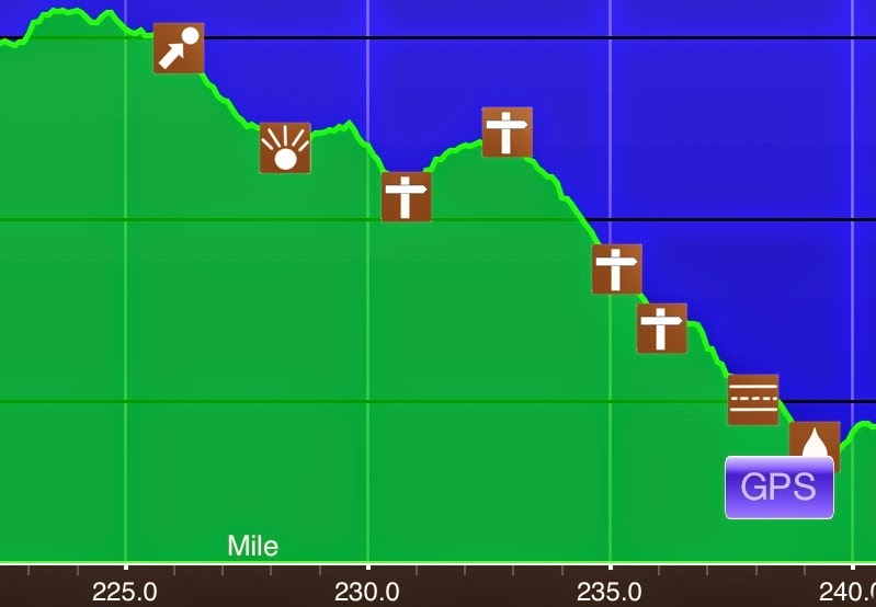
April 28th Tri-Corner Knob Shelter(222.4)-Standing Bear Hostel(240.5)N Carolina/Tennessee 18.1mi+1.2mi side trail=19.3mi Elevation chart courtesy of Guthook's AT Hiker app. Icons not significant. He has apps for many trials including the PCT and CDT. So thankfully, it...
Day 11: A Big Day In The Smokies
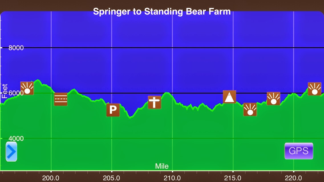
April 27th Double Spring Gap Shelter(196.0)-Tri-Corner Knob Shelter(222.4)N Carolina/Tennessee 26.4mi Elevation chart courtesy of Guthook's AT Hiker app. He has apps for many trials including the PCT and CDT. I woke up excited to go to Clingmans Dome Tower. It's a...
Day 10: Early Spring In The Smokies
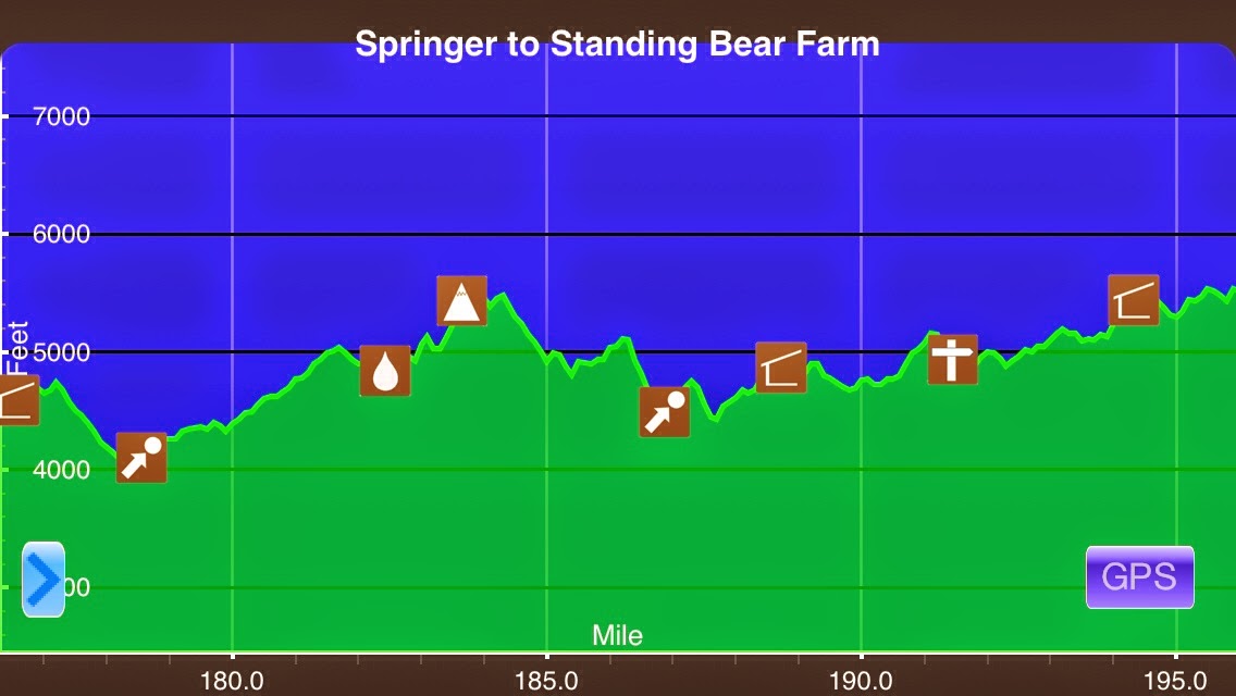
April 26th Mollies Ridge Shelter(176.8)-Double Spring Gap Shelter(196.0) N Carolina/Tennessee 19.2mi Elevation chart for today courtesy of Guthooks AT Hiker app. He has apps for many other trails including the PCT and CDT. Last night, I worked out my plan for going...
Day 9: Whew, Close One!
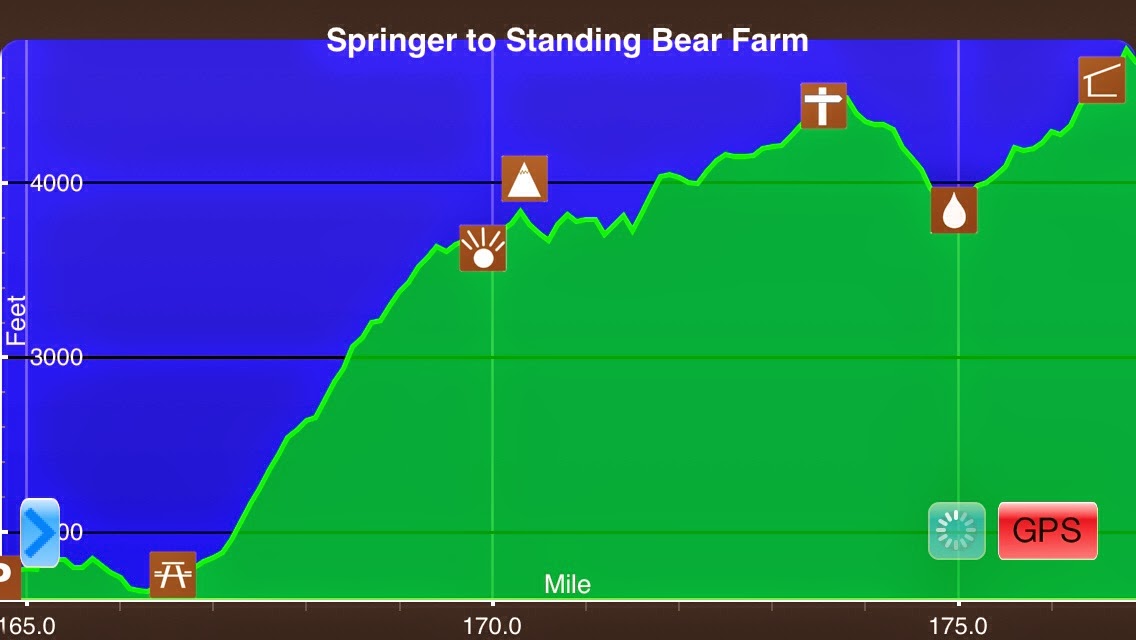
April 25th Fontana 28/Fontana Dam Lodge(164.7)-Mollies Ridge Shelter(176.8)N Carolina & Tennessee 25mi I've noticed that Guthook AT Hiker App allows me to show the elevation chart each day, so I think it will be fun to include it each day. My internal clock just...
Day 8: Yup, Definitely NOT Flat
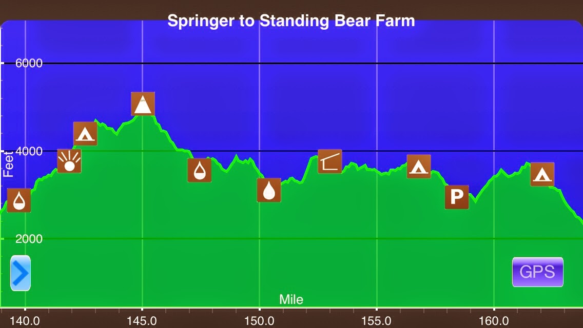
April 24th Spring before Wade Sutton Memorial(139.7)-Fontana 28/Fontana Dam Lodge(164.7) N Carolina 25mi **Before I start about today, I added a picture to yesterday that I forgot. It was one showing the leaves filling in a bit in lower elevation. It was the first day...
Day 7: A Day of Views
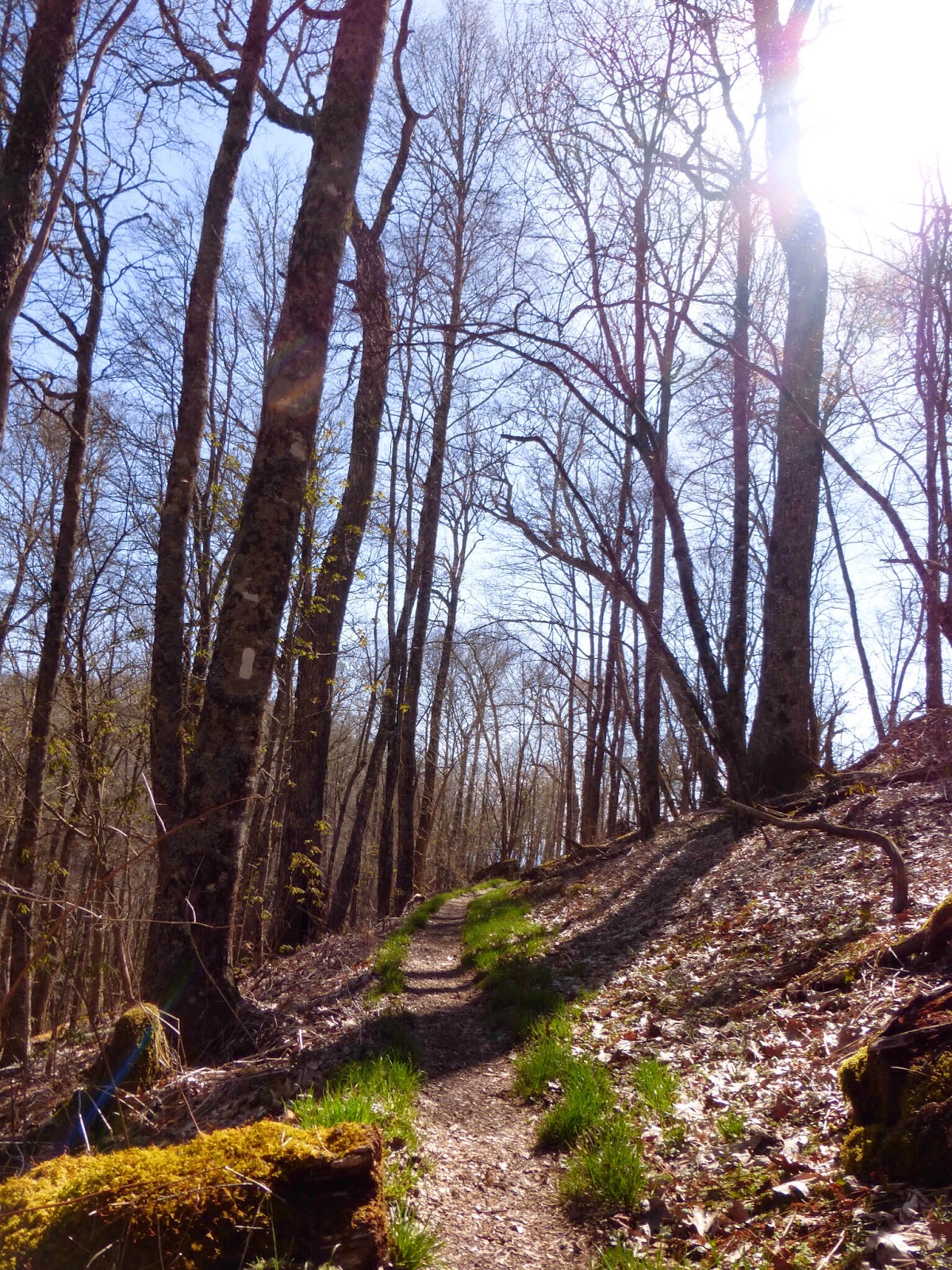
April 23rd Wayah Crest Picnic Area(115.6)-Spring before Wade Sutton Memorial(139.7) N Carolina 24.1mi It was a crisp cold morning in the upper 30s. It took me a bit to get motivated to get out of the warm sleeping bag, but I was hiking by 7:15am. I did some...


