
Sponsors


Day 7: Stupendous & Serendipitous (Part 1)
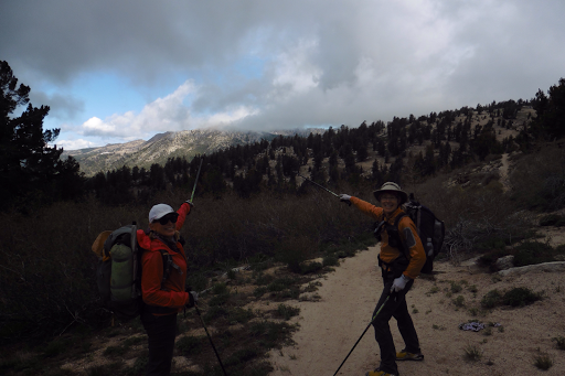
June 8thJust N of the Tahoe-Yosemite Trail Junction(114)-Echo Lake Chalet(132.9)18.9miAlternate Title: Lakes & LoveThis elevation chart is a screenshot from Guthook's TRT Guide App.Note: Rockin has a TON of amazing photos from today on her blog. Today...
Day 6: Returning HOME
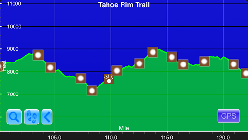
June 7thMeadow Below Twin Peaks(92.6)-Just N of the Tahoe-Yosemite Trail Junction(114)Campsite Elevation: 8,086ft21.4miThis elevation chart is a screenshot from Guthook's TRT Guide App.It stormed a bit more last night and then was clear the rest of the night. Since we...
Day 5: This Is The Life!
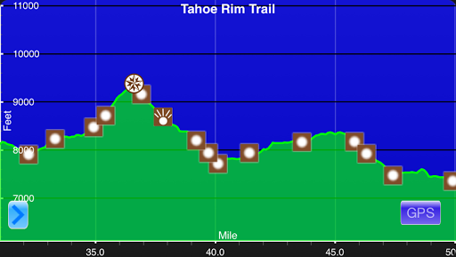
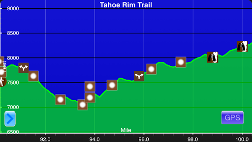
June 6thTahoe City(82.9)-Meadow Below Twin Peaks(92.6)Campsite Elevation: 7,434ft9.7miThis elevation chart is a screenshot from Guthook's TRT Guide App.Today was just glorious by my standards. A day like today is why I love thru hiking. There was nothing specific that...
Day 4: Of Course We Did!
June 5thGray Lake Junction(52.6)-Tahoe City(82.9)30.3mi (+.8 town walk)=31.1miThis elevation chart is a screenshot from Guthook's TRT Guide App.We got pretty darn lucky up on that exposed ridge last night and it was calm...until about 4:30am when the...
Day 3: Rockin' Gets Her Wish
June 4th Tunnel Creek Rd(32.4)-Gray Lake Junction(52.6) Campsite Elevation: 9338ft 20.2mi Note: Rockin' posted a bunch of great photos from today. www.ladyonarock.com Oh what a day! We knew we had a high chance of rain or storms today and got up a bit earlier to get...
Day 2: Lakeview Hiking
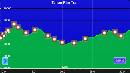
June 3rd1mi S of Sierra Canyon Trail Junction(10.1)-Tunnel Creek Rd(32.4)Campsite Elevation: 7766ft22.3mi+1.2mi overlook trail=23.5miThis elevation chart is a screenshot from Guthook's TRT Guide App.The birds were chirping loudly and I woke up a bit before my 5:45am...
Day 1: Oh How I’ve Missed You!
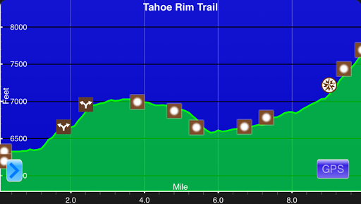
June 2nd Kingsbury S Trailhead(0)-1mi S of Sierra Canyon Trail Junction(10.1) Campsite Elevation: 8296ft 10.1mi This elevation chart is a screenshot from Guthook's TRT Guide App. Note: Both Rockin' and Why Not are blogging this trip too! www.ladyonarock.com...
Cali Baby!
Note: This entry has tons of links embedded with it to see all the things I'm referencing. A great review and walk through time for those of you that have been following for awhile. So great! I've had a great, relaxing, and restful week in California visiting friends...
Slideshow: Kanab, UT-Zion National Park (Mile 529-948.6)
Here is a slideshow from the final section chunk of the Hayduke Trail. It includes some bonus alternate miles, so the total mileage is longer than most Hayduke hikes. Click here for the direct link if you don't see it below. It often doesn't show on smart devices. For...
Day 62: Unplanned & Wonderful Ending…
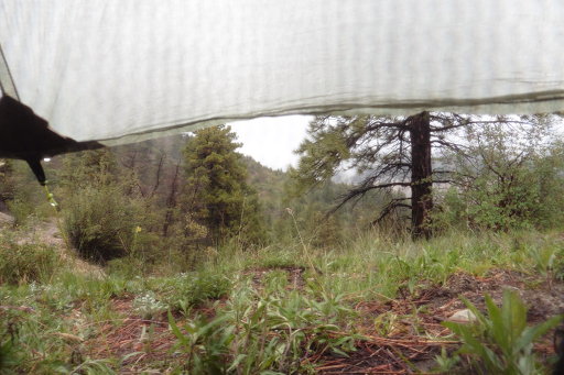
May 23rd Wildcat Trail(945.1)-Lava Point/Reservoir Rd(948.6) 3.5mi Well, even with 9,000mi of backpacking, there's always a time for some firsts. It rained all night last night and we awoke to more steady rain and 40F in my tent...so 30s outside. It did not look...
Day 61: Hayduke Finish & Bonus Traverse
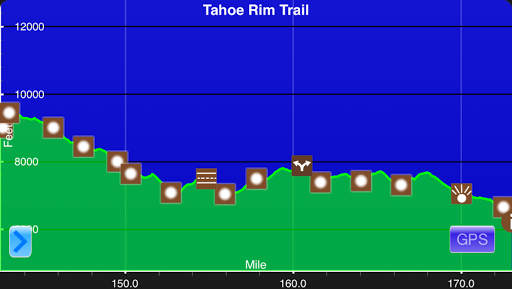
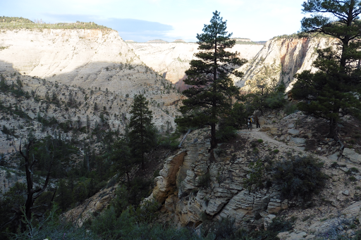
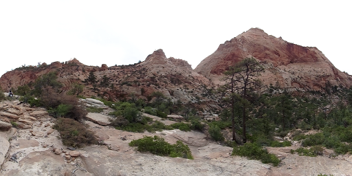
May 22ndStave Spring(922.3)-Wildcat Trail(945.1)22.8miIt was a chilly one this morning. The weather is just crazy for this late in May and we have benefitted greatly. It was just below 40 as we started hiking and stayed cool most of the day hitting the low 60s at its...
Day 60: Zion Baby!
May 21stE Fork Virgin River(906)-Stave Spring(922.3)16.3miIt was chilly last night and I wore my beanie and down jacket as I slept. We are getting really lucky with this cooler weather! Today, our first five miles were along the E Fork of the Virgin River, which...
Day 59: Walkin' On The Hayduke Beach
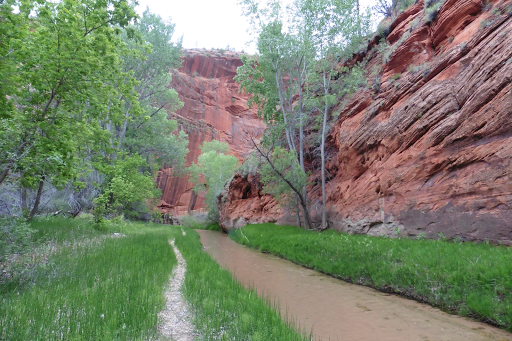
May 20thShort Creek(890.6)-E Fork Virgin River(906)15.4miThis is our final leg of the Hayduke and I'm happy that it's ending on a relaxed note. Technically, we could have done the miles to finish tomorrow at the southeast edge of Zion National Park. We are doing a...
Day 58: Colorado City Walk
May 19thHwy 385(879.2)-Short Creek(890.6)11.4miI was up til midnight last night getting blog stuff done in the hotel and woke up without an alarm at 5:45am. Hurricane and the Roadway Inn are the perfect place to zero! Sooo tempting! Very affordable, everything is...
Day 57: In The Pocket
May 19th Hack Canyon(851.1)-Hwy 385(879.2) 28.1mi When we woke up this morning, we knew we had a shot at making it to town, but we weren't sure how the miles would go. It would be over 25mi and we weren't sure that we wanted to go into town that late and waste a hotel...