
Sponsors


Day 64: A Zero Fit For A Hermit
In my last town stop, I mentioned that I knew a zero may be in my future. I'm a hermit at heart and there has been A LOT of socializing lately that has worn me down. Everyone is awesome and it's been fun, but people wear me out more than hiking. My period was the...
Day 63: Brand New Day
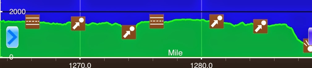
June 18th Delps Trail Campsite(1263.4)-Delaware Water Gap(1289.4) Pennsylvania 26mi Elevation chart courtesy of Guthook's AT Hiker app. He has apps for many trails including the PCT and CDT. Before I start today, I got a couple concerned emails about my use of...
Day 62: Hitting Rock Bottom…Hard
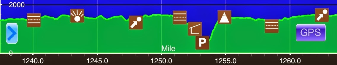
June 16thJust S of Ft Franklin Rd(1237.4)-Delps Trail Campsite(1263.4) Pennsylvania26miElevation chart courtesy of Guthook's AT Hiker app. He has apps for many trails including the PCT and CDT. I had many titles in mind for today's post. To give you an idea of how the...
Day 61: Let The Rock Hopping Begin
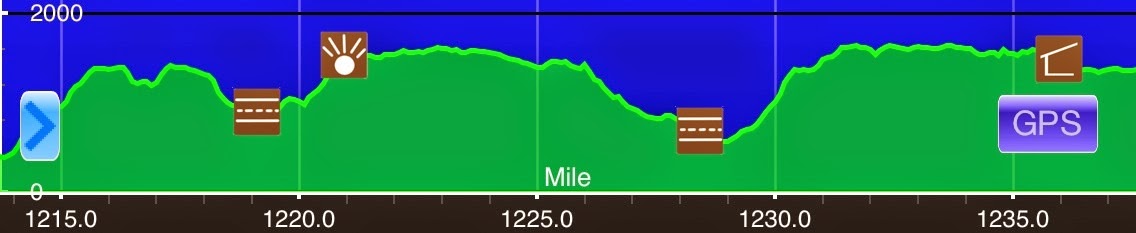
June 16th Port Clinton(1213.7)-Just S of Ft Franklin Rd(1237.4) Pennsylvania 9mi Elevation chart courtesy of Guthook's AT Hiker app. He has apps for many trails including the PCT and CDT. I forgot to mention yesterday that when I tried to turn on my stream drenched...
Day 60: A Nero To Port Clinton, PA
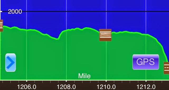
June 15th Eagles Nest Shelter(1204.7)-Port Clinton(1213.7) Pennsylvania 9mi Elevation chart courtesy of Guthook's AT Hiker app. He has apps for many trails including the PCT and CDT. It's pretty late and I still have lots to do, so this will be a quick summary...
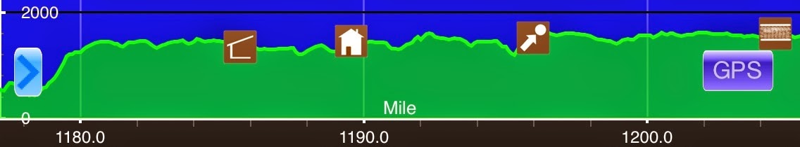
Day 59: Unplugging The Humidifier
June 14thCampsite N of PA 443(1176.9)-Eagles Nest Shelter(1204.7) Pennsylvania27.8miElevation chart courtesy of Guthook's AT Hiker app. He has apps for many trails including the PCT and CDT. I awoke this morning to no humidity and cooler temperatures! A reprieve from...

Day 58: In The Zone
June 13thCampsite at Clarks Ferry Shelter(1146.5)-Campsite N of PA 443(1176.9) Pennsylvania30.4miElevation chart courtesy of Guthook's AT Hiker app. He has apps for many trails including the PCT and CDT. So today is Friday the 13th...with a full moon! Of course today...
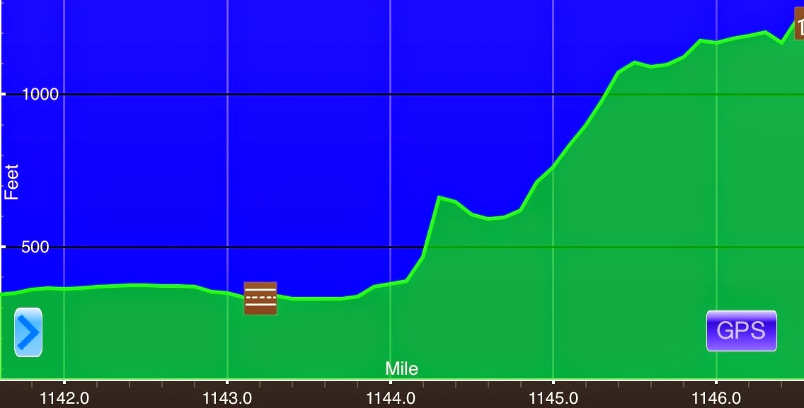
Day 57: Ugh, Back Into The Rainforest
June 12thDuncannon(1141.6)-Campsite at Clarks Ferry Shelter(1146.5) Pennsylvania4.9miElevation chart courtesy of Guthook's AT Hiker app. He has apps for many trails including the PCT and CDT. Note: Today's elevation chart is deceptive given the low mileage so of you...
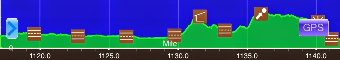
Day 56: Makin' It Happen Again!
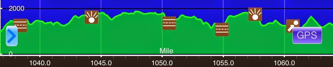
June 11thBoiling Springs Backpacker's Camp(1117)-Duncannon(1141.6) Pennsylvania24.6miElevation chart courtesy of Guthook's AT Hiker app. He has apps for many trails including the PCT and CDT. The campsite next to the train tracks wasn't too bad last night. I remember...
Day 55: Adjusting To A New Normal
June 10th Just N of the Midpoint(1092.8)-Boiling Springs Backpacker's Camp(1117) Pennsylvania 24.2mi Elevation chart courtesy of Guthook's AT Hiker app. He has apps for many trails including the PCT and CDT. It rained off and on through the night, but stopped by the...
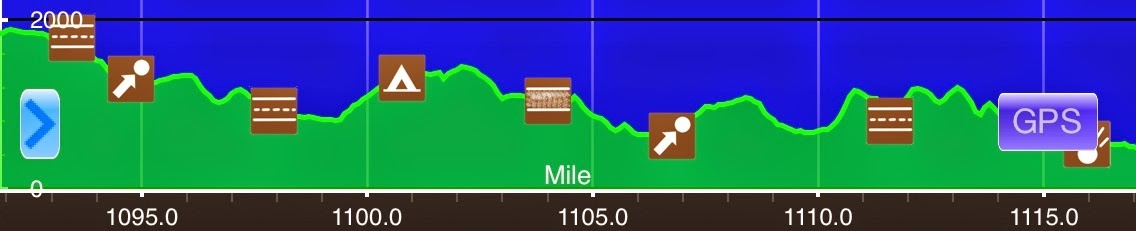
Day 54: HALFWAY On A Humid Day
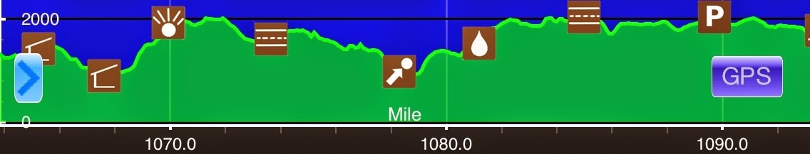
June 9th Spring S of Deer Lick Shelter(1063.9)-Just N of the Midpoint(1092.8) Pennsylvania 28.9mi Elevation chart courtesy of Guthook's AT Hiker app. He has apps for many trails including the PCT and CDT. The rain mostly stopped around 12:30am last night. The rest was...
Day 53: On My Own Again
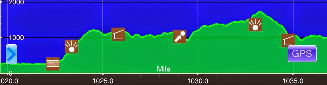
June 8thDahlgren Campground(1036.8)-Spring S of Deer Lick Shelter(1063.9) Maryland/Pennsylvania27.1mi+.7 side trails=27.8miElevation chart courtesy of Guthook's AT Hiker app. He has apps for many trails including the PCT and CDT. I didn't set an alarm this morning,...
Day 52: Hiking With Family & Friends
June 7th Harpers Ferry (1019.5)-Dahlgren Campground(1036.8) West Virginia/Maryland 17.3mi Elevation chart courtesy of Guthook's AT Hiker app. He has apps for many trails including the PCT and CDT. It's is a late night in my tent and it was a jammed packed day, so I'm...
Day 51: A Zero In Harpers Ferry, WV
June 6th I stayed up til 12:30am last night doing blog anf email things. This is just my third zero and many things had built up over the past 780mi. I thought I might sleep in today, but nope, I was wide awake at my regular 6am. I stayed at Shanti's until 1pm and the...
Standing Bear Farm-Harpers Ferry (240.5-1019.5)
At the end of a section every few weeks, I like to load all the pictures and videos I've taken as a summary of that section. I did a big gap between bounce boxes this time, so here is the slideshow of the past 780mi from Standing Bear Farm to Harpers Ferry. Many of...